Ciclismo in Peru
Explore activities, routes, destinations and travel tips for Ciclismo in Peru.
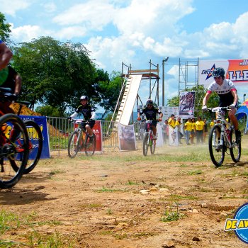
Ciclismo Activities
View all →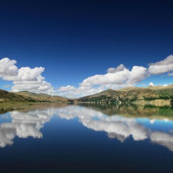
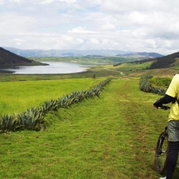
01 DAY MOUNTAIN BIKING AT POMACANCHIS LAGOON
This new spectacular and cultural circuit offers i...
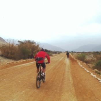
DOUBLE EXTREME DUATLON: BIKES + RAFTING
Nuestra ruta Doble Extreme suma a la Trocha del Sh...
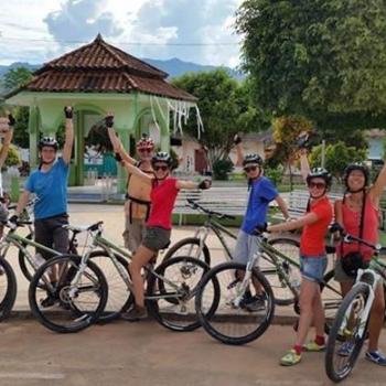
LA RUTA DE LOS NATIVOS CHANCAS LAMISTAS FULL DAY
Descripción: El full day de Amazon Mountain Biker...
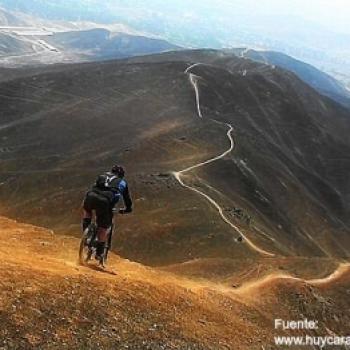
Bicicleta de Montaña en la Cordillera Blanca
Descripción: La Cordillera Blanca en el corazón...
HUANCAYA - VILCA todos los fines de semana
Huancaya Paraíso natural al estilo del Club Mochil...
Ciclismo Routes
View all →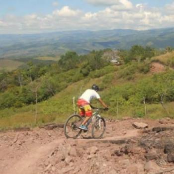
Cycling in Aucaloma
This route starts from Aucaloma (San Roque de Cumbaza) heading towards Tarapoto, crossing the entire road to Tarapoto; we must be attentive due to the large number of curves. This route is ideal for amateur and professional mountain bikers as it requires technique and endurance to cover the 14 km distance. The level of difficulty is moderate, not only because of the distance but also because it requires climbing a 3.4 km hill before the initial descent. This route can be done throughout the year; its difficulty level is moderate due to the ascents, descents, and distance. Photo: Amazon Mountain Bike...
Mountain Biking in Cajamarquilla
"Cycling in Cajamarquilla is a great alternative for wheel sports enthusiasts. Embarking on this route will be a fascinating journey for all adventure tourists who take on the challenge." Cajamarquilla is located in the Jicamarca Valley, 24 km from Lima. It sits at an altitude of 340 meters above sea level and covers an area of approximately 167 hectares. It is situated along the Huaycoloro Gorge, between the districts of San Juan de Lurigancho and Chosica. Climate in Cajamarquilla: The climate in Cajamarquilla is mostly sunny throughout the year, making it a recommended destination to visit at any time. December - March: It is not advisable to go cycling during these months due to seasonal rains caused by its proximity to the mountains. Route to reach and cycle in Cajamarquilla: To reach Cajamarquilla, take a bus to the central highway until the entrance of Huachipa. From there, enter Cajamarquilla Avenue until reaching a turnoff indicating the way to Santa Cruz neighborhood. About 200 meters from Cajamarquilla, you will find the interpretation center, where you can request access to the "labyrinth" area by paying 5 soles for entry, which is a restored zone. Technical details of Cajamarquilla: Location: Jicamarca Valley, Lima Altitude: 340 meters above sea level Climate: Warm Best season: April - November Difficulty level: Easy Mode: Freestyle ...
Cycling in Canchacalla
"Canchacalla is one of the areas where various types of adventure sports can be practiced. One of the most visited cycling routes is located in this place, which is why it is recognized among downhill sports enthusiasts as a special area for adventurers." Canchacalla is located in the province of Huarochirí at an altitude of 2,500 meters above sea level. It is part of the Lima highlands. Climate in Canchacalla: The climate in Canchacalla is temperate and warm. April - November: It is a very good season to explore Canchacalla, due to its temperate climate, which allows for a better appreciation of the area to be explored. Cycling Route in Canchacalla: Depart from the center of Lima towards Chosica, to take any bus or transportation that will leave us in Canchacalla. Once in the area, the descent will begin through the Fruit Forest of the Valley, then continue through the towns of Salpán, Lanca, and Cumbe. Technical Data in Canchacalla: Location: Huarochirí - Lima Altitude: 2,500 meters above sea level Climate: Temperate Best Season: April - November Difficulty Level: (B) Medium Modality: Downhill What to Bring for Downhill in Canchacalla? Sunscreen. Rehydrating drink. Cycling shorts. Long-sleeve dry fit cycling jersey. Windbreaker jacket. Sunglasses. Cycling gloves. ...
Cycling in Canchaque
Canchaque is located in the province of Huancabamba, in the department of Piura. It has an altitude of 1,198 meters above sea level. It is located between the Mishahuaca and Cerro Campanas hills, between the Limón and Carrizal gorges. Climate of Canchaque: Its climate is temperate, almost all year round. May - October: It is a very good time to go cycling in Piura, as the weather is mild. Cycling route, Canchaque - Huancabamba: The route should start from the city of Piura and ascend to the east. Continue until you reach the town of Canchaque. From there, continue the ascent towards the Cruz Blanca pass at 3,000 meters above sea level and zigzag towards the town of Huancabamba. This route is highly recommended for experienced cyclists. We suggest carrying water and warm clothing....
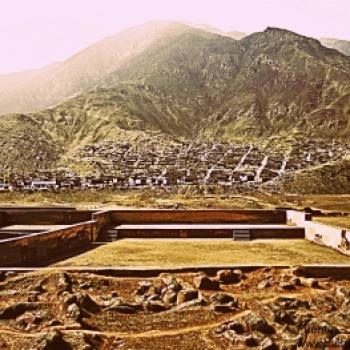
Cycling in Caral
"Caral is one of the most visited tourist complexes by researchers and tourists in the province of Lima, as it is considered a World Cultural Heritage. Additionally, it is ideal for cycling in Caral, being one of the most popular routes for enthusiasts of this sport." Caral is located in the Valley of Supe, 206 km north of Lima. It covers an area of 66 hectares and sits at an altitude of 350 meters above sea level. Caral is considered a World Cultural Heritage site and dates back around 5,000 years. Climate in Caral It has a warm climate for most of the year. April – December: This period is recommended for cycling in Caral due to the mild weather. Route for Cycling in Caral To explore Caral from Huacho (North of Lima). Start from Huacho towards Huaura, where you will ride your bikes along the crop route parallel to the Pan-American Highway. Continue until Km. 160, where you will reach the town of Vegueta. At this point, you will find the entrance leading to the city of Caral. This path is quite sandy (Approx. 23 km of sand), so it is recommended to reduce speed or walk. After about five hours, you will see the ruins next to the river. At this point, you will be inside the citadel of Caral. Technical Details of Caral Location: 206 km north of Lima Altitude: 350 meters above sea level Climate: Warm Best Season: April - December Difficulty Level: (A) Easy Mode: Free Style Video: Kintu Visual Media...
Cycling in Chinchero
Cycling on the Chinchero route is one of the most unforgettable routes for adventure tourists visiting Cusco, which is why it is recommended by thousands of adventure sports enthusiasts to engage in various extreme sports. This route offers a wonderful journey, allowing you to discover the high part of the Sacred Valley of the Incas, while enjoying impressive landscapes such as large mountains and snow-capped peaks. Along the way, you will also pass by the archaeological sites of Maras, Moray, Salineras, and Chinchero. This route, with its narrow paths, ascents, and descents in the mountains, allows you to observe the traditional agricultural life of the local inhabitants while being in contact with nature. Where It Takes Place This adventure takes place in Chinchero, located in the Province of Urubamba, 28 kilometers from Cusco. This village sits at an altitude of 3,754 meters at the crossroads of three roads connecting Cusco, Yucay, and Pumamarca. Route Depart from Cusco towards the Sacred Valley of the Incas, stopping in Chinchero and continuing towards the community of Cruz Pata, where the cycling journey to Moray begins. Upon reaching Moray, continue towards the town of Maras, then proceed to the Salineras. Upon reaching the Vilcanota River, it will be time to return, as the Chinchero – Maras – Urubamba route will have been completed. Photo: incaworldperu Time This route, when organized by agencies, takes a full day, including some stops to visit the tourist attractions along the way. Distance The route covers an approximate distance of 30 kilometers. Type Cross Country Season This sport can be practiced at any time of the year, although the best season for this adventure is between the months of May and September, when the weather is mild and the landscapes can be better appreciated. Level This route requires an intermediate level in mountain biking. Video: doguiromero78 What to Bring Backpack with personal belongings. Comfortable clothing. Cycling or sports shoes. Spare camera. Light jacket for rain and wind. Cap for sun, rain, or cold protection. Sunscreen. Sunglasses. Insect repellent. Water in disposable container. Helmet. Gloves. Inflator. Multi-tool. Recommendations Hire a specialized tourism agency to provide this service, so you can be guided by a professional familiar with the routes....
Cycling in Chirimoyo Pachacámac
"Mountain biking in Pachacamac is one of the best options for adventure sports enthusiasts. You don't need a lot of experience to practice this sport in this area, but you do need a lot of enthusiasm to embark on such an exciting journey." Photo: Diete Sánchez Where it takes place There are several routes for practicing this sport in the district, the most popular being the Chirimoyo route, which starts at the famous "el mexicano" spot, where you can park your car, eat, and socialize with other cyclists. This route ends at the Chirimoyo ravine. Routes The Chacra - Beginners La Cieneguilla and Manzano - Intermediate El Chirimoyo - Experts El Lúcumo - Experts Las Lomas - Intermediate Distance On average, the routes cover a distance of 20 km. Modality Cross country Downhill Season It can be done throughout the year, but the best time is between April and December. What to bring Helmet Bike in good condition Gloves Sunscreen and insect repellent Lycra shorts Spare inner tube Pump Water bottle Video: José Luis Egusquiza Recommendations: If it's your first time mountain biking in Pachacamac, it's advisable to start with the "La Chacra" route to get to know the terrain....
Cycling in Colca
Mountain biking is very popular in the Colca Valley, passing through the most incredible landscapes and beautiful viewpoints are some of the experiences that this adventure sport offers in the Colca. Photo: Arequipaxtremo Where it takes place It starts from the town of Chivay until reaching the main square of Cabanaconde. Distance More than 100 km (round trip) Level Intermediate with good physical condition Modality Cross Country Season Between June and August. What to bring Helmet Bike in good condition Gloves Sunscreen and insect repellent Lycra Tire tube Pump Plenty of water First aid kit Hydrating fruits Energy bars Video: Producciones Ampato Recommendations Make stops at places like the Condor viewpoint, and the various attractions that the Colca Valley has to offer to enjoy this great experience even more....
Specialized Agencies
View all →
Adventure Perú Tours
Urbanización Bancopata M-6, Santiago - Cusco
...

advisor and travel
av. circunvalacion 114 Abancay - Apurimac
Estamos incursionando en turismo de aventura e...


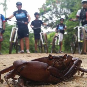
AMAZON MOUNTAIN BIKERS
Jr. Capirona 160 Tarapoto
Somos una empresa ecoTurística cuya actividad prin...


Apuro Pedal
Cl. Parca Mz. f l. 5 San Fernando Pachacamac
A Puro Pedal S.A.C. es una promotora de e...
Community Adventures
View all →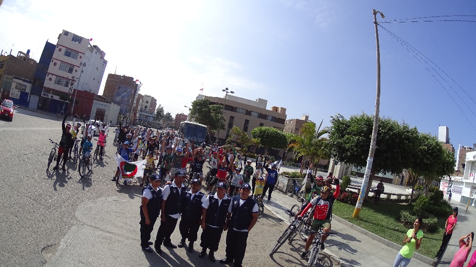
Rolling through the land - Chakrabike Club event
Celebrating Earth Day in advance, with a tour that started in the city of Chiclayo and headed to the Ventarron archaeological site (dating back 4000 years), a Chakra Bike adventure....
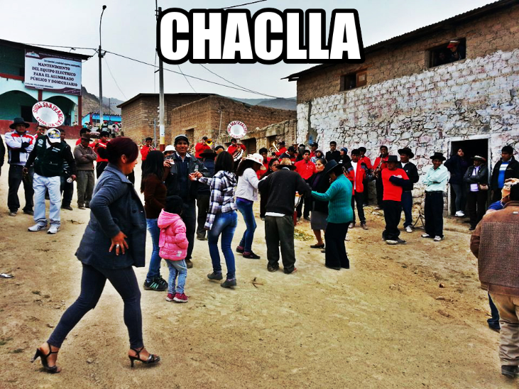
SAN ANTONIO DE CHACLLA
Be part of one of the 32 districts of the province of Huarochirí at 3457 meters above sea level...
Resurrection Sunday with the Chakras
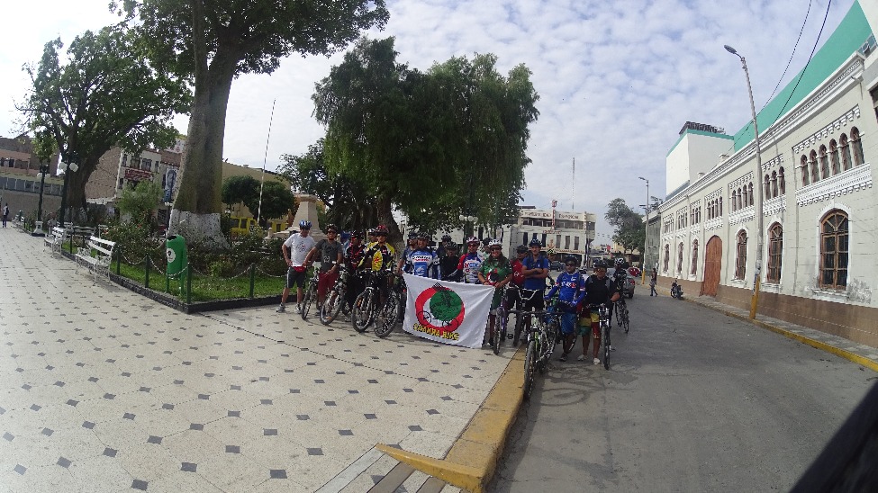
It all starts in the city of Chiclayo, from there we set off on a bicycle tour with a group of 30 to 40 cyclists, including competitive riders. We ride through Chiclayo, then Monsefú, the city of Eten, until we reach Puerto Eten, where the Lighthouse is located... with an incredible ascent to a hilltop where the Lighthouse stands, it's a great place to showcase what cyclists and two-wheel travel enthusiasts are made of... Being at the top is a cool experience. And the descent is the best part, feeling the speed, the air, the wheels sliding, it's a great adventure worth repeating....
GHOST TOWN OF PAMPAS
It belongs to the province of Huaral in the department of Lima....
MARCAHUASI
It is a plateau in the Andes mountain range, located to the east of Lima....
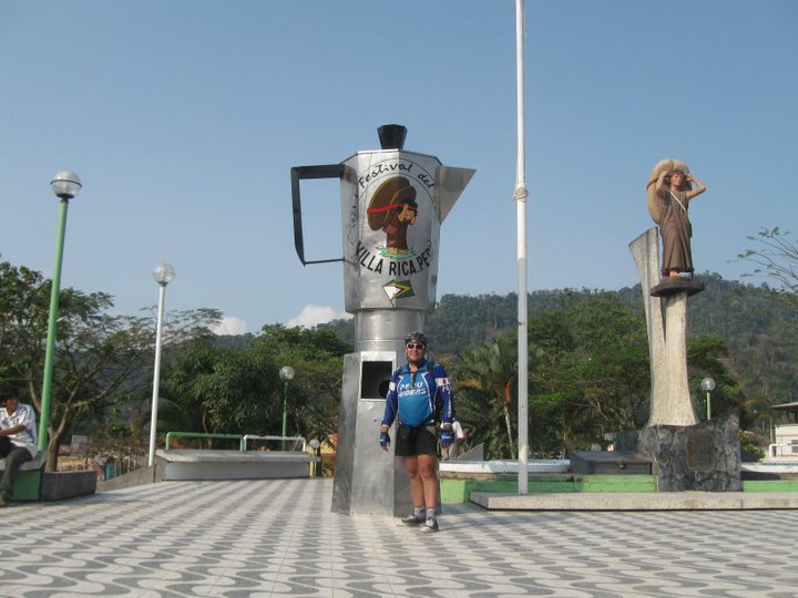
VILLA RICA
Located to the east of the Pasco department...
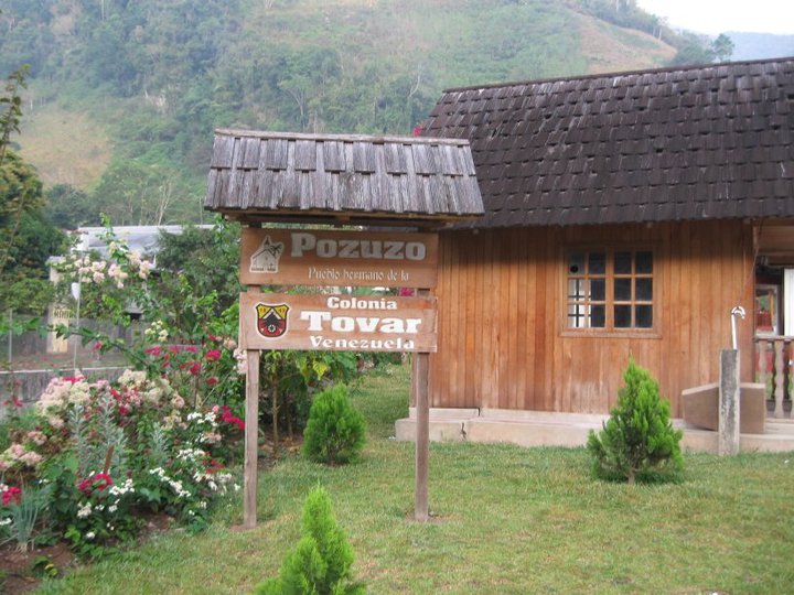
POZUZO
Pozuzo is one of the 8 districts that make up the province of Oxapampa, located in the department of Pasco....
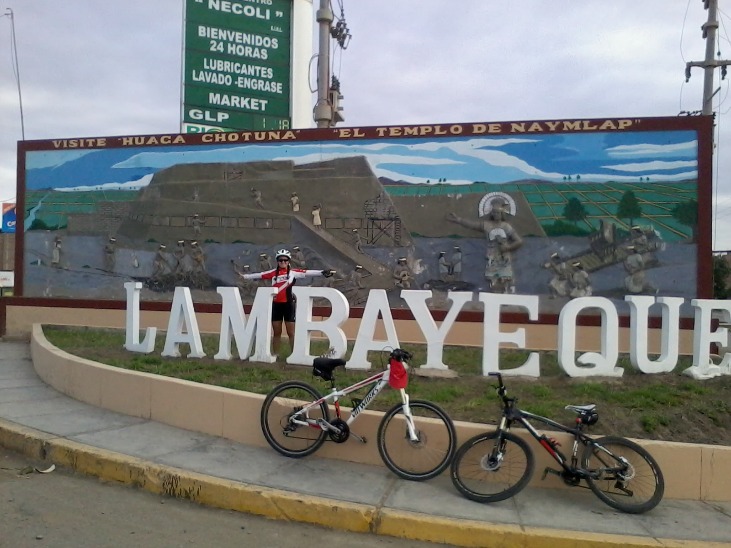
Túcume Pyramids
We cycled from Chiclayo to the district of Túcume to visit its pyramids. Túcume is located 33 km away from the city of Chiclayo. We passed through Lambayeque and Mochumi where we stocked up on rehydrants. The landscapes are beautiful....
Articles about Ciclismo
View all →
¿Qué llevar en tu primer viaje de aventura?
Has decidido hacer un cambio en tu vida, llenarte de experiencias y dejar un poco l...
Top 5: Lugares de aventura que debes conocer
Tenemos la suerte de haber nacido en Perú. Un país con tantas riquezas naturales, d...
Resumen del campeonato de MTB Santísimo Downhill 2017
Resumen de la novena edición del Santísimo Downhill, la más importante comp...
Eventos de Ciclismo de Montaña 2017
La pasión de los ciclistas sumado a la correcta utilización de los espacios naturales ha hecho que s...
Festival Inca Avalanche 2016: Ciclismo de montaña en las alturas incas
El pasado 1 de Mayo terminó una ed...

TOP 5: Eventos de ciclismo en el Peru este 2016
El ciclismo en el Peru es uno de los deportes de aventura que más am...
2do Rally de Ciclismo de Montaña: Reto Amazon Mountain Bikers 2015
El pasado fin de semana salimos de Lima, con el fin de llegar a la calurosa y tan querida ciudad de ...