Escalada in Peru
Explore activities, routes, destinations and travel tips for Escalada in Peru.
Escalada Activities
View all →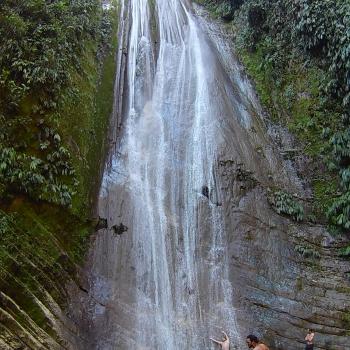
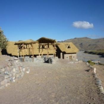
PARQUE NACIONAL DEL RIO ABISEO 2 dias 1 noche
Pasa un excelente fin de semana lleno de adrenalin...
.JPG)
.jpg)
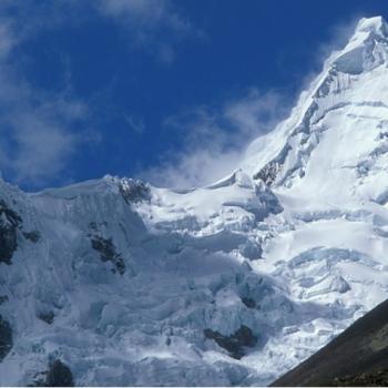
NEVADO ALPAMAYO - CEDROS GRAN TREKKING
El Nevado Alpamayo es un recurso natural que se en...
Escalada Routes
View all →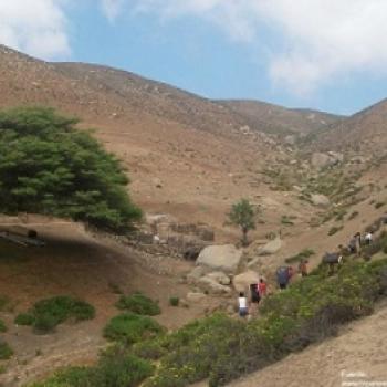
Rock Climbing in Atiquipa
"The Lomas de Atiquipa is the perfect place to start rock climbing, as its geography allows for good training for adventure tourists who wish to practice this extreme sport, making the experience highly recommended." Atiquipa is located in the province of Caraveli, in the department of Arequipa. It has an altitude of 325 meters above sea level. It is an excellent place for rock climbing, as its mountains and green hills are ideal for this extreme sport. Climate in Atiquipa: The climate in Atiquipa is temperate and dry, with temperatures averaging around 20°C. December - August: This is the best season for rock climbing in Atiquipa, as it is a dry season. Route to Atiquipa: To reach Atiquipa in the province of Arequipa, you must head south on the highway to kilometer 601 and reach the town of Santa Rosa, then take the road to Jihuay Beach. In the Jihuay area, there are around 30 open blocks distributed in three zones. The zones are: Left and Right facing the sea, The hills, and Dry river. In the Lomas Forest (the best preserved in Peru), rock climbing can be done. Technical data of Atiquipa: Location: Caravelí - Arequipa Altitude: 325 meters above sea level Climate: Temperate - Dry Season: December - August Type of Climbing: Rock Climbing Difficulty Level: Easy What to bring for rock climbing in Atiquipa? Mountain boots. Climbing pants. Water bottle. Flashlight with spare bulb and battery. Sunscreen. First aid kit. ...
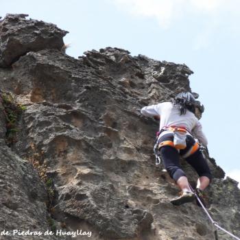
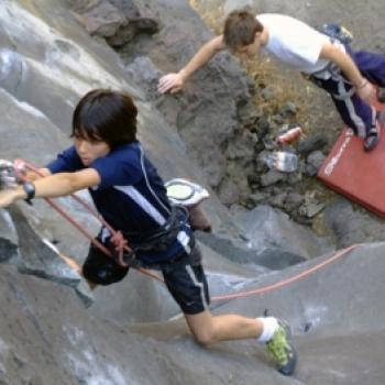
Rock Climbing in Huayllay Stone Forest
The Huayllay Stone Forest is considered one of the Seven Wonders of Peru, that's why it's a must to travel to Pasco and practice climbing on its huge rocks shaped like humans and animals. Photo: andineta.blogspot The Huayllay Stone Forest is located in the National Sanctuary of Huayllay, in the province and department of Pasco. It has an altitude of 4,310 meters above sea level. It has more than 4,000 rock formations, closely resembling human and animal profiles. Where it takes place As mentioned before, the Huayllay Stone Forest has over 4000 rock formations, most of them of volcanic origin, and in recent years, some climbing routes have been established. The sectors are often at long distances from each other, and there are even equipped routes that have been forgotten over time due to lack of information. Sectors "Los Primos" Sector Named after the Spanish cousins Jairo and Tito, who equipped these 3 routes in 2008. Both climbers from Pedriza, Madrid. For routes 1 and 3, it is necessary to use the appropriate gear to protect the natural rock formations. The pioneers of this sector recommend climbing carefully and not relying solely on the bolts. Photo: toposperu "Siete Llaves" Sector It is a transversal valley where a dirt road runs through. Facing it is the rock wall called "half moon," one of the most challenging climbing routes. In Siete Llaves, you can find the tallest walls in the Forest. Level Thanks to the different rock walls in the Forest, there are routes suitable for all levels of climbers, each with varying degrees of difficulty. Season The ideal season to visit this wonder is between the months of May and October when the rainy season ends. What to bring Certified climbing harness. Climbing helmet. Anchoring rope. D-shaped carabiners with safety lock. Descender/Belay device. HMS or Pear-shaped carabiner with safety lock. Sewn 120 cm. sling. Certified maillon. 5.5mm cord. Dynamic climbing rope, 10 to 10.5mm in diameter and 60-70 meters long. Petzl Grigri with safety carabiner. Recommendations We recommend visiting the Forest on the first weekend of September when the Ruraltur event takes place, focused on adventure tourism and nature. Video: BaseCampPeru...
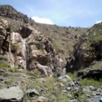
Rock Climbing in Calambucos
Just 20 minutes from the White City lies an unmissable destination for brave rock climbers. Calambucos awaits them to engage in this great adventure sport. Very close to the city of Arequipa, about 10 kilometers to the northwest, you'll find Calambucos. It is located in the Calambucos ravine, at the foothills of the Misti volcano. Climate in Calambucos: The climate is dry and sunny almost all year round, with temperatures ranging from 10 to 21 degrees. • From June - August: Winter season, with temperatures dropping to 8 degrees below zero. • From January - April: Rainy season, causing the river level to rise. Route to get to Calambucos: From the city of Arequipa, you can take buses heading towards the town of Independencia, which is very close to the district of Calambucos. During the journey, you should get off at the path leading to the canyon and walk to the fork. It is advisable to take this route with a local guide, as there is only one. From there, you will descend into the canyon, where you will find two routes. Continuing 1 km to the left, you will come across a white rock marking the rappel point to “Chocho loco”. The most recommended route for beginners is the lower part, known as “La escuelita”. ...
Escalada en Callalli
This climbing destination in Callalli offers a great variety of rocks and routes to explore. Here, nature prepares a perfect place for adventure sports that you can't miss for anything in the world. � The district of Callalli is located in Caylloma, Arequipa. It is situated at an altitude of 3,850 meters above sea level. This tourist destination is ideal for climbing, as it is the highest rock formation in all of Arequipa and a perfect site for engaging in adventure sports such as climbing. The nature of these rocks is explosive volcanic, of the ignimbrite type. Climate in Callalli: The temperatures in this area of Arequipa average 16°C in the morning, but drop below zero during the night. April - November: Recommended time to visit Callalli as the weather is mild and there is no risk of rain. November - March: It is the rainy season, so climbing is not highly recommended. Precipitation is higher during February. Route to get to Callalli: From the city of Arequipa, take a bus towards Chivay. The journey takes approximately two and a half hours. From Chivay to Callalli, take another vehicle, covering a distance of 35 km, usually taking a little less than two hours. The next stretch is done on foot, from the Plaza de Callalli to the Castles. It is only 1 km that can be covered in 15 minutes. Climbing routes in Callalli: Plaque sector (9 routes):- Routes from right to left. First orgasm. Collective masturbation. One month of solitude. Both feet in the water. Arch. Goat's foot history. Against the current. Jacques, Bernard I will remember you. From one Bacquet to another. Condor sector (5 routes): The scream of the wind. The condor puñuña. A sherpa's story. To lost friends. The Irish stroll. Great Jacques sector (4 routes): The Irish doll. The great Jacques. Global warming (2 pitches). The cleaning gentleman (2 pitches). Tourist attractions in Callali: Standing out in this district are the Enchanted Castles of Callalli, which are a set of geological formations on large volcanic rock cliffs. The separations between the columns are astonishing, and the erosion gave rise to the origin of this castle. Colca Mollepunko Gate. Rock shelter where we find Pachachaca Bridge, a colonial bridge built with volcanic material and rounded stones. San Antonio, Catholic parish church. Llapa Yanahuara, Collagua-Inca-Colonial village where the church built on a pre-Hispanic huaca and the main square stand out. Technical Data of Callalli: Location: Caylloma - Arequipa Altitude: 3,850 meters above sea level Climate: Temperate Best season: April - November Difficulty level: Easy Type of climbing: Rock climbing What to bring for climbing in Callalli? Mountain boots. Thermal socks. Gloves with wool or fleece lining. Climbing pants. Drinking water. Flashlight with spare bulb and battery. Sunscreen. Tent. First aid kit. ...
Climbing in Canchacalla
A place where experience and learning are combined in the adventure of climbing is undoubtedly Canchacalla. An unmissable destination located a few kilometers from the city of Lima. In the Lima highlands, at kilometer 41 of the central highway, you will find the town of Canchacalla in Huarochirí. Just three hours from the city. This destination is characterized by its maze-like streets and ancient balconies. Located at around 2,500 meters above sea level in the valley of the same name, Canchacalla is known by the Lima climbing community as the “school”, as it has many rock walls and different routes with varied difficulty levels that allow beginners to learn the sport and experienced climbers to enjoy the discipline. Route to reach Canchacalla: We depart from the city of Lima heading east on the central highway towards the Canchacalla valley. We stop at kilometer 41 to then embark on a hike of at least half an hour. The applied modality is Top Rope, meaning with a safety rope at all times. This adventurous destination is ideal for those who enjoy rock climbing. Sectors to climb in Canchacalla: La Quina Sector “Beginner's Plate” Sector “Three Cracks”. Cracken Sector. Torax. The Community. The Staircase. The Big Roof. On the Ramp. The Low Book. The Ramp. Fifth Route Wall. Block Overhang Zone, The Basement. Technical details of Canchacalla: Location: Huarochirí - Lima Altitude: 1000 meters above sea level Climate: Temperate Best Season: September - May Difficulty Level: Medium Climbing Type: Rock Climbing What to bring for climbing in Canchacalla? Climbing shoes. Sunscreen. Insect repellent. Mid-season clothing. Sweater. Water. ...
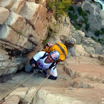
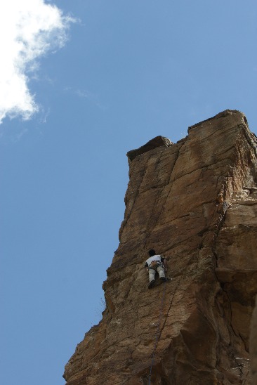
Climbing in Colca
"The Colca Canyon is one of the largest canyons in the world, which is why it is a major attraction for adventure tourists who practice rock climbing. Additionally, it offers a beautiful landscape of the city of Arequipa, making it an amazing experience." The Colca Canyon is located in the Andes Mountains, 162 km northwest of Arequipa. It is twice as deep as the Grand Canyon in the United States, but not as steep. One of the most visited spots for rock climbing is the Ventana del Colca, situated at 4,300 meters above sea level. Here, you can spot representative species of the flora and fauna of the area, such as Ichu and tola grasses, as well as pumas and foxes. Climate at Ventana del Colca: The average annual temperature is 10°C. May - November: This is a good time for climbing in the area, as it is the dry season. February - April: These months are highly recommended as the landscape looks more stunning than in other seasons. It is the rainy season. Route to reach Ventana del Colca: Head towards Puno until the crossroads of Chivay, then follow the road for approximately 45 minutes to the junction towards Cusco, continue for another 30km until you reach a stone construction that resembles a condor, then walk for 5 minutes. Technical Data of Ventana del Colca: Location: Andes Mountains - Arequipa Altitude: 4,160 meters above sea level Climate: Dry Season: February - April Difficulty Level: Medium Climbing Type: Rock climbing What to bring for rock climbing at Ventana del Colca? Mountain boots. Thermal socks. Gloves with wool or fleece lining. Waterproof windbreaker jacket. Climbing pants. Pants with fleece lining. Altitude goggles. Water bottle. Flashlight with spare bulb and battery. Sunscreen. First aid kit. Quickdraws and fixe anchor (The distance between anchors is 4 to 5 meters). ...
Escalada en El Chipche
"El Chipche es una zona de escalada...

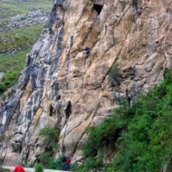
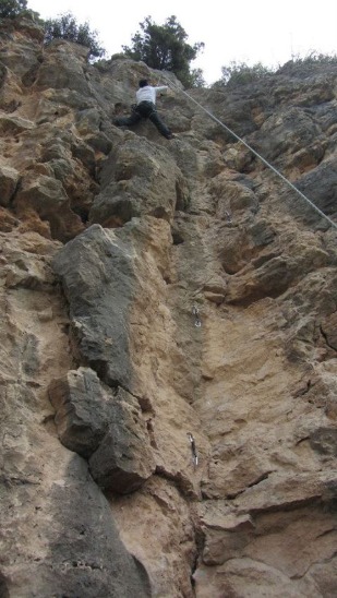
Rock Climbing in Hatun Machay
"The well-known stone forest of Hatun Machay is a meeting point for adventure tourists who practice rock climbing, making this an unforgettable place due to the experience it represents." Hatun Machay is located in the Cordillera Negra between Huaraz and Conococha. It has an altitude of 4,200 meters above sea level. It is located in the Puna or Jalca region. Its extension is 200 hectares. On this mountain, we can find different types of rock: Granite eroded by water, wind, and glaciers. Volcanic rock. Climate in Hatun Machay: The climate in Hatun Machay is tropical. May – November: This season is highly recommended as it has a dry climate and allows for comfortable practice of adventure sports such as rock climbing. December – April: This season is also suitable for extreme sports as it is a wet period, with sunny mornings and rainy afternoons. Route to reach Hatun Machay: You must take the road towards Huaraz passing Conococha until you reach the turnoff to Pampas Chico (kilometer 131) to the left, 11km past Conococha. Follow the road for about 25 minutes and look for a change in the road that will lead you to the left, after five minutes you will arrive at Hatun Machay. Technical Data of Hatun Machay: Location: Between Huaraz and Conococha Altitude: 4,200 meters above sea level Climate: Tropical - Dry Season: May-November Difficulty level: Medium Climbing type: Rock climbing What to bring for rock climbing in Hatun Machay? Small backpack with all the necessary items. Comfortable shoes. Shorts. Extra shirts. Energy bars and snacks. Hat. First aid kit. Binoculars. Water. Sunscreen. Camera. ...
Specialized Agencies
View all →
Adventure Perú Tours
Urbanización Bancopata M-6, Santiago - Cusco
...
AGENCIA DE TURISMO TESOROS DEL GRAN PAJATEN
Jr: Malecon N° 222
Somos una agencia de turismo que está vinculado...

aTeam Peru Travel
Calle Jerusalen 312 - Cercado
Ofrecemos tours en Arequipa. Trekking, rafting en ...

aTeam Peru Travel
Calle Jerusalen 312 - Cercado
Ofrecemos tours de caminatas, rafting, canopy en A...
Ayacucho Zamy Tours
Portal Independencia 66, Ayacucho, Perú
Ayacucho es fascinante por ser un destino en el qu...
Bezgranic Traveler
Lima,Breña- Av. arica 259
Pórque viajar con PERU BEZGRANIC Perú bezgranic s...

Carlos Zarate Aventuras
Calle Jerusalen 505-A AREQUIPA . PERU
somos un gran equipo humano. Al que de alguna m...
Community Adventures
View all →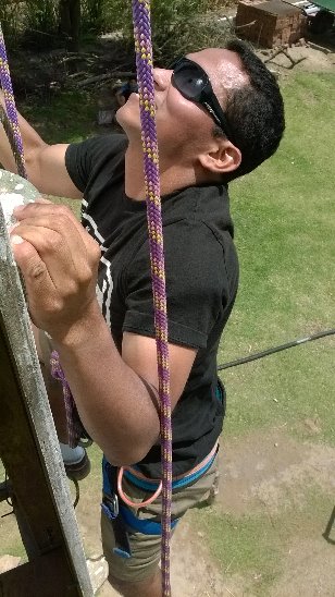
CLIMBING AT LAGUNA CONACHE
GREAT AND FUN SPORT....

A way of life
I must start by explaining that climbing in my life has evolved from being just a sport to a lifestyle. I train every day at the climbing gym and at the Vanna Coach training center to achieve my goals for the year. This time, an unexpected trip came up, which everyone was talking about. A new climbing area located in Huayhuay. They showed me photos of 30-meter walls, wow. I didn't think twice and joined a group of climbers sponsored by the NGO Vida, who provided us with all the comforts to reach our goal. On the way to the location, we could see thousands of walls with impressive potential, we were amazed. I positioned myself on a route of approximately 30 meters that didn't have an exact grade yet, some said 6c+, others 7a. All I can say is that it was an unforgettable experience, climbing long routes at an altitude of 3,500 meters above sea level with your friends. I managed to complete the entire route, until I reached the final part where the most challenging section was. An overhanging slab with small holds. Getting through all that was a mix of endurance, technique, and a lot of strength, encouraged by the shouts of everyone saying "Go, you're almost there!". This is what we train for, for moments like this where strength, technique, and a lot of mental focus come into play. It's the moment when you have to be absolutely sure of your moves, because if you hesitate, you fall, and it's a long way down. In the end, I can only say, I'm glad I made it. Those are the best moments, where you only hear your breathing and the wind fluttering your shirt. Each word of encouragement gets lost in the wind and sounds like a whisper. That's climbing, full of projects. You can never say you've done it all, there are always challenges and more challenges. People travel in search of challenges. That fuels us and gives us the strength to keep training....

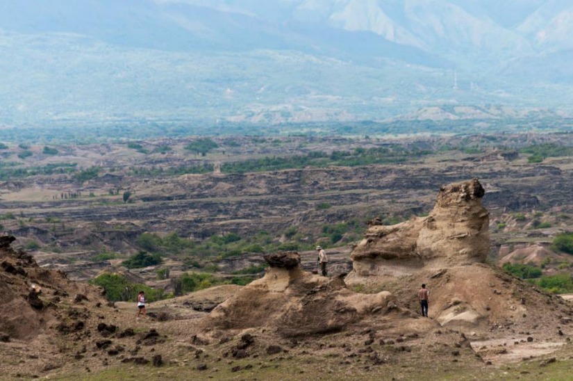
Discovering New Places
It was a very fun day, worth visiting the Tatacoa Desert....
Exploring Boulder Climbing
Training a bit at THE WHITE MONKEY CAVE in Arequipa And others in Guatape in Medellin, Colombia...

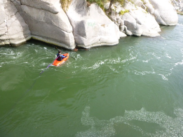
Rafting in the Colca
Slacklining is a balance sport where a line is anchored between two fixed points, usually trees, and tensioned. Slacklining differs from tightrope walking in that tightrope walking involves walking on a fully tensioned metal cable, whereas slacklining involves walking on a flat nylon or polyester webbing. This sport differs from slack rope walking in that it uses flat webbing instead of a rope, as ancient tightrope walkers did. Similarly, in slacklining, no tools are used to assist in maintaining balance, such as poles or other means....


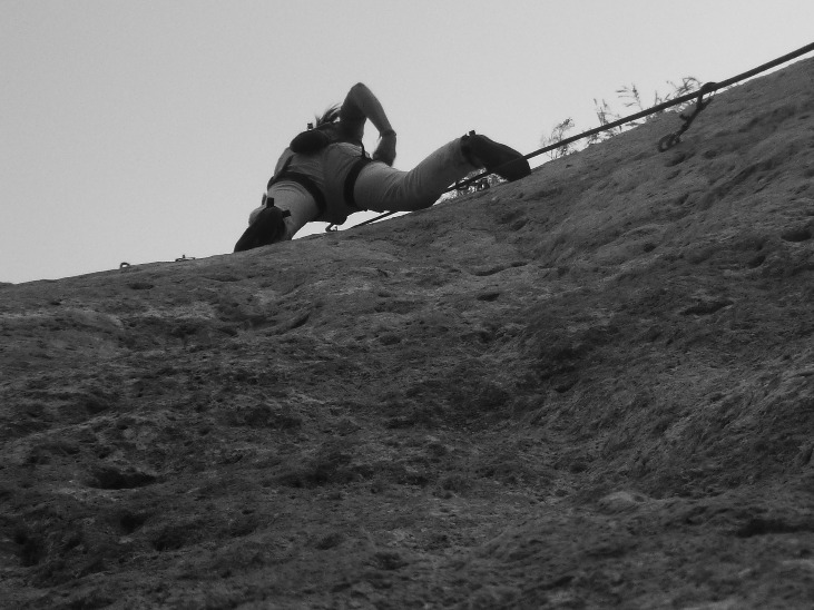
Traditional Climbing
Traditional climbing in an area near Lima, Vichuya just a few minutes past Cieneguilla....