Cycling in Caral
Sport: Ciclismo
Route Description
"Caral is one of the most visited tourist complexes by researchers and tourists in the province of Lima, as it is considered a World Cultural Heritage. Additionally, it is ideal for cycling in Caral, being one of the most popular routes for enthusiasts of this sport."
Caral is located in the Valley of Supe, 206 km north of Lima. It covers an area of 66 hectares and sits at an altitude of 350 meters above sea level. Caral is considered a World Cultural Heritage site and dates back around 5,000 years.
Climate in Caral
It has a warm climate for most of the year.
April – December: This period is recommended for cycling in Caral due to the mild weather.
Route for Cycling in Caral
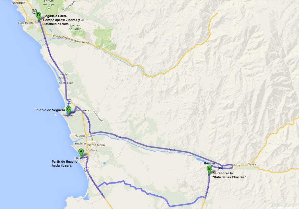
To explore Caral from Huacho (North of Lima).
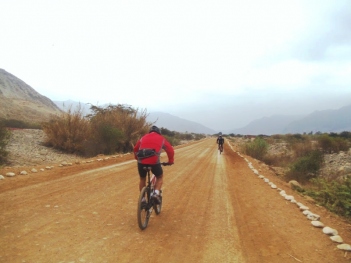
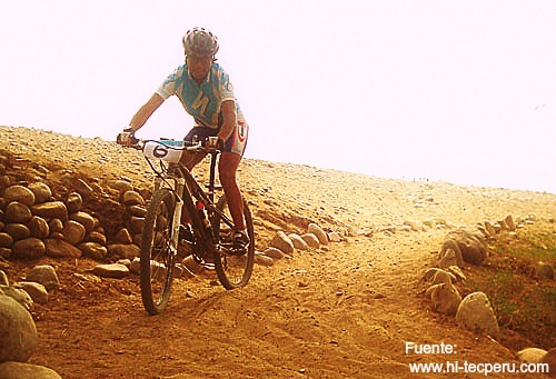
Start from Huacho towards Huaura, where you will ride your bikes along the crop route parallel to the Pan-American Highway. Continue until Km. 160, where you will reach the town of Vegueta. At this point, you will find the entrance leading to the city of Caral. This path is quite sandy (Approx. 23 km of sand), so it is recommended to reduce speed or walk. After about five hours, you will see the ruins next to the river. At this point, you will be inside the citadel of Caral.
Technical Details of Caral
| Location: 206 km north of Lima | Altitude: 350 meters above sea level |
| Climate: Warm | Best Season: April - December |
| Difficulty Level: (A) Easy | Mode: Free Style |
Video: Kintu Visual Media
Key Data about Caral
Altitude
350.00
Best Season
Abril a Noviembre (temporada seca)
Climate
Desértico costero
Natural Region
Costa
Distance
25.50 km
🏃 Available Activities
There are no specific activities registered for this route at this time.
Explore All ActivitiesPlanifica tu aventura
Solicita información o cotizaciones para esta experiencia.
Cycling in Caral