Trekking in Peru
Explore activities, routes, destinations and travel tips for Trekking in Peru.
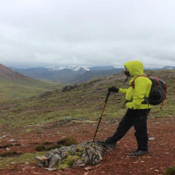
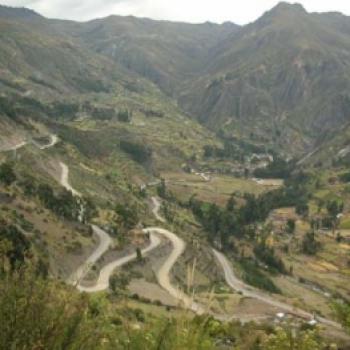
Trekking Activities
View all →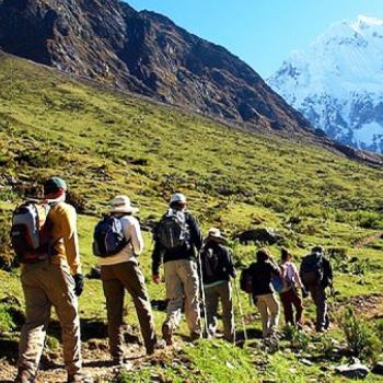
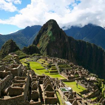
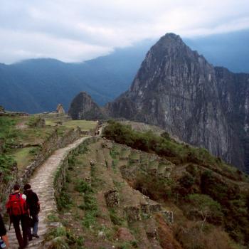
Camino Inca y Machu Picchu 4 Días 3 Noches
La imponente Ciudadela de los Incas, nos lleva a r...
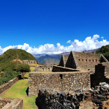
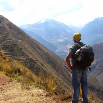
Choquequirao Trek 5 Días 4 Noches
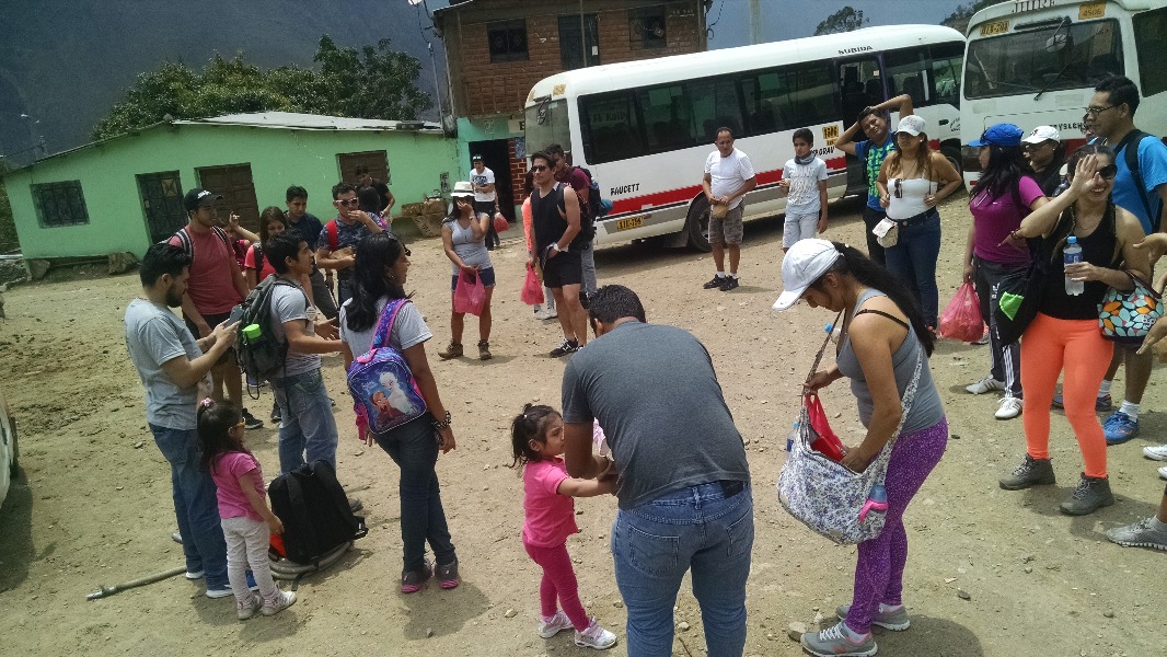
Choquequirao, son las ruinas de una ciudad inca si...
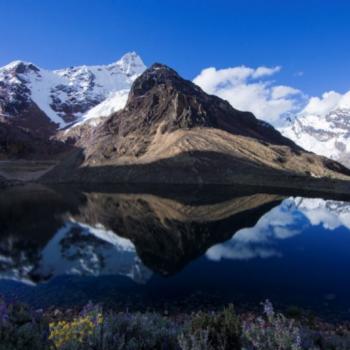
Ausangate Trek 4 Días y 3 noches
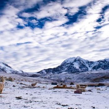
Ausangate es la quinta montaña más alta del Perú, ...
Lares Machu Picchu en 4 dias y 3 noches
La ruta de Lares o Lares Trek, comienza cerca del ...
Camino Inca y Machu Picchu en 2 Días 1 noche
El Tahuantinsuyo estuvo atravesado por cientos de ...
Camino Inca de Chinchero a Urquillos en medio Día
El Tahuantinsuyo estuvo atravesado por cientos de ...
Trekking Routes
View all →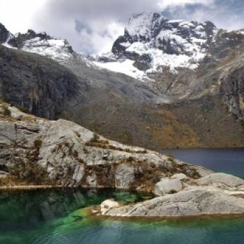
Trekking to Laguna Churup
"At the top of the Cordillera Blanca we can appreciate how extraordinary nature can be. There, where the snow-capped mountains thaw, the peaceful Churup lagoon is born, located at an altitude of 4,450 meters". The Churup lagoon is located between the towns of Llupa and Pitec, in the Huascarán National Park. It is situated at an altitude of 4,450 meters above sea level. This lagoon gifts us with an impressive turquoise color that blends with warm hues at sunset. This major tourist attraction for travelers is one of the most visited in Áncash and is only minutes away from Huaraz. The route: Many tourists take a bus from the center of Huaraz to the town of Pitec, located to the east of the province. The journey lasts no more than twenty minutes and passes through the towns of Unchus and Llupa. The fare does not exceed five soles. At the beginning of the hike, you enter the Churup gorge and from there you will encounter rough terrain. There are even parts where rock climbing is required. After the initial ascent, the landscape becomes flat, vegetation is visible, and you will feel the change in altitude. The birdsong provides the necessary encouragement to reach the desired destination. Additionally, you can observe waterfalls cascading over rocks. Finally, after about three hours of hiking, you will behold the unique landscape offered by the Churup lagoon. There you will notice the reflection of the Churup snow-capped mountain and the presence of a second lagoon, with calm waters and much smaller in size. Technical Data of Churup Lagoon Area: 867,640 m2 Difficulty: Moderate Depth:145 meters Climate: Dry and temperate Altitude: 4,450 meters above sea level Best time to visit: April-November Climate: The Churup lagoon has an average temperature of 18ºC. It generally has a dry and temperate climate. Recommendations: Light clothing Boots Hat Insect repellent Sunscreen Snacks Camping tent (optional) ...
Trekking to Marcahuasi
Impressive monuments with human and animal shapes accompany the way to the Marcahuasi plateau, one of the Seven Wonders of Peru. The enigmatic history surrounding it creates an atmosphere of mysterious peace for adventurers who enjoy Trekking. Photo: luisparodi.wordpress.com It is almost mandatory to engage in this discipline if you want to visit Marcahuasi, as access roads can only be traversed on foot, horseback, or with a donkey, although this option becomes challenging due to the steep terrain along most of the route. Trekking Route to Marcahuasi To reach Marcahuasi, one needs to be in good physical condition, as the hike requires considerable endurance. The adventure begins in the district of San Pedro de Casta, one of the 32 districts of the Huarochirí Province. A huge church stands in its uneven square, and from there, the journey to Marcahuasi begins. This circuit can be done on horseback (three hours) or you can choose between two paths. The shorter one takes two to three hours and leads you to the Monument to Humanity, standing at 25 meters high; the second, longer path takes you to the amphitheater area, the best place to camp due to its wind-protected location. - Walking Distance The distance is over 12 km, passing through slopes, more than 15 ravines, and very narrow dirt paths. Along the way, you will see attractive landscapes, brown and green mountains, feeling like you are ascending to the sky. - Difficulty Level The route is very challenging due to the terrain, distance, and especially the high altitude of the location. It is recommended to undertake this activity for individuals in good physical condition, with an intermediate level of trekking experience. - Duration of the Journey It takes approximately 4 hours to reach Marcahuasi. - Season The best time to visit Marcahuasi is between April and October when rainfall decreases. What to Bring Sneakers or trekking shoes with good grip Camping tent (preferably for high altitudes) Flashlight Camera Matches or lighter Still water 2 to 5L Dried fruits (raisins, pecans, etc.), chocolates, lemon candies, etc., for quick energy replenishment Sunscreen, cocoa butter for lips or lip balms, gloves, scarf, caps, and/or woolen hats Two sets of clothes: jacket (preferably waterproof or fleece), warm pants Sleeping bag First aid kit containing primarily an inhaler Trekking Video in Marcahuasi Video: TraveleandoPeru Recommendations If you are camping, bring warm clothing as temperatures drop significantly at night, also a good tent that can withstand cold and strong winds. Bring all necessary items before leaving San Pedro de Casta because you won't find any commerce in Marcahuasi. Reserve pack animals in advance, as on busy days, the rental of donkeys and horses can get saturated. If you prefer not to carry your luggage for 4 hours, it's better to arrange this ahead of time. Reference: reference: municipalidadsanpedrodecasta.gob.pe...
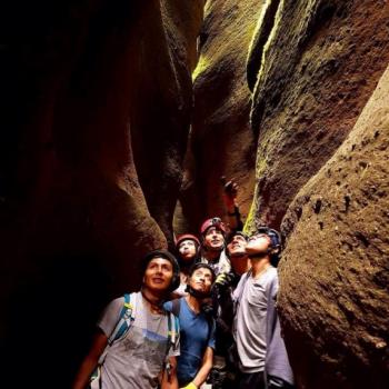
Trekking in the 7 canyons of Qorihuillca
Magical place where the walls narrow, giving rise to winding corridors of endless mazes, ideal for trekking, it will envelop you in an adventure movie. Where is the sport practiced? The 7 Canyons of Qorihuillca is located in the district of Qorihuillca chico, in the province of Huamanga, 6 km from the city of Ayacucho. Distance: Gradient: 2727 masl Maximum Altitude: 2834 masl Travel time: The activity lasts 6 hours Season: Any day of the year, as its climate is cold-temperate What to bring? High-top shoes or sneakers Sunglasses Insect repellent Sunscreen 1 L of water Waterproof clothing Cap Light clothing for walking Camera Recommendations Acclimatize one day before the activity. Bring extra money. Follow the instructions of the assigned guide. ...
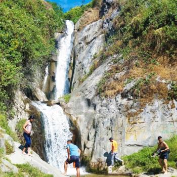
Antankallo Trekking
To access Antankallo, it is mandatory to do trekking, an incredible route full of beautiful landscapes, ideal for people who want to start in this popular adventure sport. Photo: huancayaperu The Antankallo waterfall, also known by some as "the waterfall of friendship," is located just a few hours from the center of the capital and is considered one of the main tourist attractions in the department of Lima. Where It Takes Place The route starts from the center of Matucana, a district belonging to the province of huarochirí, in the department of Lima. Route As mentioned, the route starts from the center of Matucana. First, you pass through flat terrain until you cross a small log bridge. After that, the path gains height through a zigzagging area until reaching a flat surface with some slopes. Then, you climb a hill, cross a wooden bridge, and finally reach the 45-meter high Antankallo waterfall to observe, enjoy, and take a dip in its waters. Along the way, you pass through 2 suspension bridges, observe rock formations known as Lion's Head and the Face of Christ, as well as apple and quince orchards and the caves where shepherds rest. The entrance fee to the waterfall is very affordable at 2 soles. Photo: Daniel Flores Level This is a very easy trekking route, suitable for all people. It is recommended for those who want to start in this sport. Distance The total distance of this route is 2.5 kilometers. Time The journey takes 1 and a half to 2 hours to complete. Season The best time to do this adventure is between the months of April and November, a season when the rains end and the area has a warm climate during the day. Video: Viajaporperu.com What to Bring Bottled water Insect repellent Light clothing Jacket for the afternoon Hat Trekking shoes or high-top sneakers Recommendations We recommend staying to camp in the area, as it is equipped with latrines for this activity....
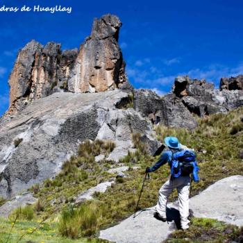
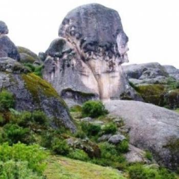
Hiking in the Stone Forest of Huayllay
Doing trekking in Huayllay Stone Forest is a unique experience. Exploring its nearly 7000 hectares is an adventure that is never forgotten. Photo: turismoescolar.wordpress Huayllay Stone Forest is a rocky area, almost entirely (90%) of volcanic origin. It is considered one of the 7 wonders of Peru, thanks to its more than 4000 rock formations resembling human and animal profiles, where adventure sports such as trekking can be practiced. Where it takes place There are 11 trekking routes to explore the Forest, here are the main ones so you can imagine a bit about the adventure in this wonder. First route Starting from the town of Canchacucho heading northeast, after 30 minutes of walking you reach the first monument, the Baby Dinosaur, followed by the Elephant. Continuing on the north side, you pass by important figures such as the explorer, the alpaca, the mushroom, the toad, the condor, and the window. Then you head west, reaching Curagaga, a 15-meter-high cliff. Next, you go along the southeast path, reaching the Portal, a 15-meter-high by 6-meter-wide rock formation. Then you head south, back to Canchacucho, where you can observe different formations such as the reclining boy, the cat hunting its prey, the hand, the lamb, among others. Second route In this route, you explore the northwestern side of the Forest, observing formations such as the monolith, the alien heads, the turtle, the tunnel, the cuchipinta, and the spectacular Valley of the Nuns. Duration On average, the routes take about 6 hours, it's impossible to explore the entire Forest in just one day. To fully explore it, it takes several days, including rest. Level It's a trekking experience suitable for individuals with an intermediate level in this adventure sport. Season The ideal season to visit this wonder is between the months of May and October, when the rainy season ends. Photo: XuranD Gomez What to bring Sneakers or trekking shoes with good grip Bottled water Hydrating fruits Comfortable clothing Warm clothing for the night Sunscreen Recommendations We recommend taking this tour by hiring an agency, some of which offer services from Lima and provide the opportunity to spend a weekend experiencing the adventure of exploring Huayllay Stone Forest. Video: Trekking and Adventure...
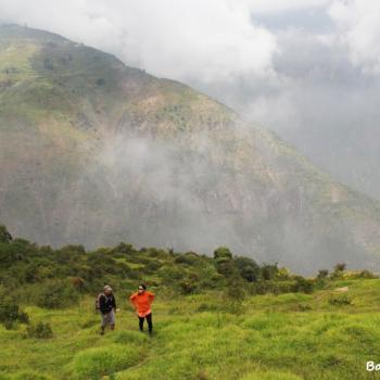
Zárate Forest Trekking
The Zárate Forest is located in the district of San Bartolomé in the province of Huarochirí, covering an area of over 500 hectares. In this place of great biodiversity, a variety of flora and fauna inhabit, considered one of the best places in Lima for trekking in contact with nature. This forest, named in 2010 by SERNANP as a National Protected Area, is a natural relic, one of the few that survives in the central area of the country. It is a refuge for many species, especially birds like the condor and the white-cheeked cotinga, and it also features attractive archaeological remains. Where It Takes Place The starting point is from the chapel in the district of San Bartolomé, then heading on a long and demanding hike to Zárate Forest. People who come here for this adventure usually arrive in the evening and spend the night at the Community Interpretation Center, to then depart very early the next morning towards the forest. Route It starts from the chapel in the district of San Bartolomé at 1850 meters above sea level, ascending to 3600 meters above sea level. Along this path, you will enjoy the beautiful landscapes of endless green mountains. You will witness the wide variety of flora and fauna offered by the Reserved Zone of Zárate Forest, and you can also visit archaeological remains along the way. Distance This hike covers a distance of 15 to 16 kilometers. Difficulty Level To undertake this adventure, some experience in trekking is required, as it is a demanding, long route with some abysses. Duration The journey takes a total of 9 hours (round trip), sometimes extending to 10 hours. Season The best time to visit this place is between April and June when the mountains display enchanting greenery and the ravines are filled with water. Video: My Friend Joaquin What to Bring Daypack Waterproof clothing Trekking shoes Warm socks Warm clothing Sunscreen Trekking poles Bottled water Fruits, energy bars, and nuts for the journey Recommendations It is highly recommended to hire guides or an agency to provide you with all the details, technical information, and services you need for this excursion. Photo: deportech.wordpress...
Trekking in Callejón de Conchucos
In Ancash, to the east of the Cordillera Blanca, the majestic Callejón de Conchucos unfolds. Mystical and historical landscapes converge in this tourist destination, a must-visit for adventurers who enjoy Trekking. The Callejón de Conchucos is located in the region at the eastern end of the Cordillera Blanca and comprises a set of towns such as Chavín, San Marcos, Huari, Pomabamaba, Sihuas, and more. The adventure route in the Callejón de Conchucos: Two hours by bus from Huaraz is the Catac detour that leads us to the Callejón de Conchucos. The road crosses the Querococha lagoon and the Cahuish tunnel. This is the longest tunnel in Peru, with 580 meters in length. The altitude is 4,516 meters above sea level, from there the descent of the mountain range towards the East begins, to the town of Chavín de Huantar. It is approximately a 110 km journey. The adventure begins in the city of Chavín, where you can visit the famous archaeological circuit and its new museum. The route continues through the town of San Marcos, 9 km north of Chavín de Huantar, at about 2,960 meters above sea level, in the Mosna valley. There you can take a walk through the Carhuascancha ravine, a wildlife refuge in the heart of Huascarán National Park. Also, a visit to the villages of Carash and Carhuayoc, five and ten minutes from the city center, offer cultural and historical circuits. From there, we continue through Huari, where you can visit the ecological community of Acopalca and the Dinosaur Footprints Circuit, the oldest fossil on the planet and one of the new tourist products of Conchucos. If you decide to extend your excursion and explore Chacas, the capital of the province of Asunción, there you will find the sanctuary of Mama Ashu and the Chacas museum. Next, you will pass through Huari, the capital of the province of the same name, and you will find Purhuay lagoon, the archaeological site of Marca Jirca, María Jiray waterfall, and the Huanchac area for adventure sports and rock climbing. The great adventure culminates in San Luis, the capital city of the Carlos Fermán Fitzcarrald province, located in the central part of the Callejón de Conchucos at 3131 meters above sea level. Technical data Altitude: 4516 meters above sea level Best time: May-October Climate: Temperate (12º C to 24ºC) Level: Intermediate When to go? The best time of year is between May and April as there are no rains during that season. It is not recommended to go between November and March as the first three months of the year are the rainiest. Travel recommendations: Bring waterproof clothing (the weather can surprise us) Swimwear Light clothing Sturdy shoes First aid kit Sunscreen Insect repellent ...
Specialized Agencies
View all →ACOLCA TOURS
Calle Tacna 806 - Yanahuara, Arequipa
ACOLCA TOURS es una Agencia de viajes y turismo...


Adventure Perú Tours
Urbanización Bancopata M-6, Santiago - Cusco
...

advisor and travel
av. circunvalacion 114 Abancay - Apurimac
Estamos incursionando en turismo de aventura e...
AM mas Adventures and Travel E I R L
Mz B lote 16 APV COVIDUC San Sebastián 051 Cuzco, Cusco, Peru
Ven a conocer Cusco y disfruta el Perú, con nos...

AMAZON MOUNTAIN BIKERS
Jr. Capirona 160 Tarapoto
Somos una empresa ecoTurística cuya actividad prin...
Community Adventures
View all →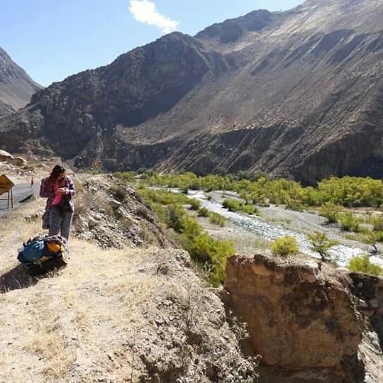
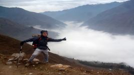
The Andean Paradise
I traveled to Huancaya via Huancayo, Junín. The journey was filled with breathtaking landscapes, transitioning from vast open meadows to being surrounded by rocky mountains almost as if they wanted to block our path, with a crystal-clear river by our side most of the time. Arriving in Huancaya was the realization of a long-awaited trip, with radiant sunshine during the day and intense cold at night. Vilca and Huancaya seem like paradise with their crystal-clear green-toned waters, a beautiful sight. Truly impressive, highly recommended 100%....
Torre Torre
Impressive structures created by the whims of nature....
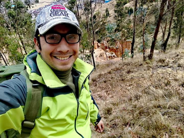
Lúcumo Hills
A visit to Lomas de Lúcumo off-season, relentless sun, barely any greenery, all to challenge yourself and test your endurance by trekking under these conditions....
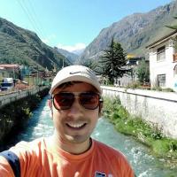
Antankallo Waterfall
Impressive hike surrounded by green hills and a sky of celestial blue with white clouds....
Huanano Waterfall
Great nature hike with a thrilling rappelling experience in between! 🧗♂️...
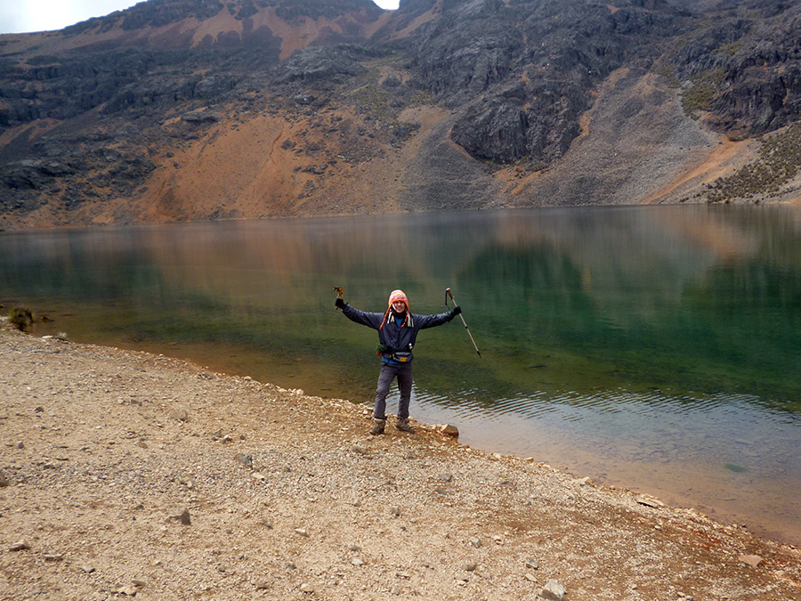
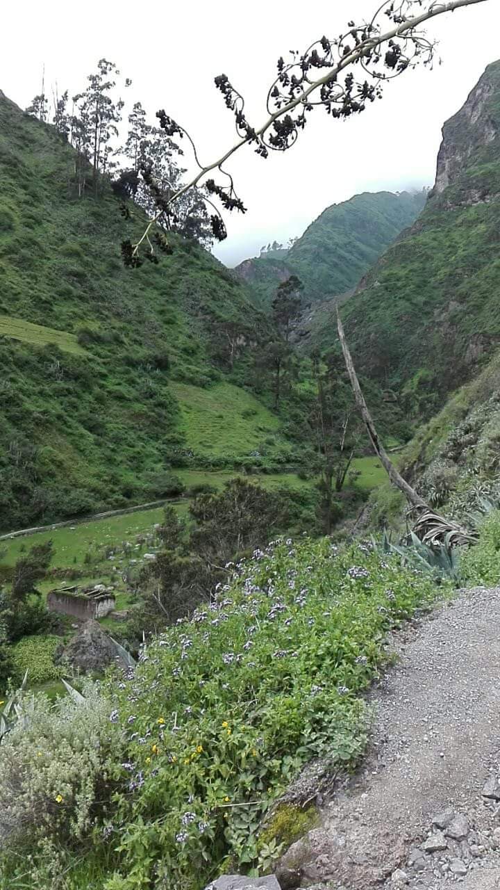
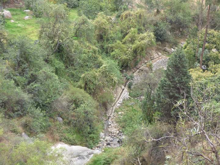
Route The Lost Ucte Lagoon
Our challenge was to conquer the great Ucte lagoon. We began the journey, arriving at the town of Ayas, we embarked on a full trekking climb, walking for over 5 hours in the mountains to reach the ruins of Huacapune. We spent the night there and continued the journey at 5 am, heading towards the Ucte lagoon, walking for over 7 hours at an altitude of 4650 meters above sea level. Thinking we would never make it, our guide told us it was beyond that peak. We motivated ourselves and kept walking towards that peak for almost two hours. When we were close, we could glimpse a magnificent natural spectacle, very still yet resonant with beauty and a color never seen by my eyes, a pure crystal green, transparent like glass. A giant lagoon lay before our eyes, I saw it and cried, it was the great Ucte lagoon. Today I can say it has been conquered. I still remember it in my memories. I will return for you, my beautiful Ucte....
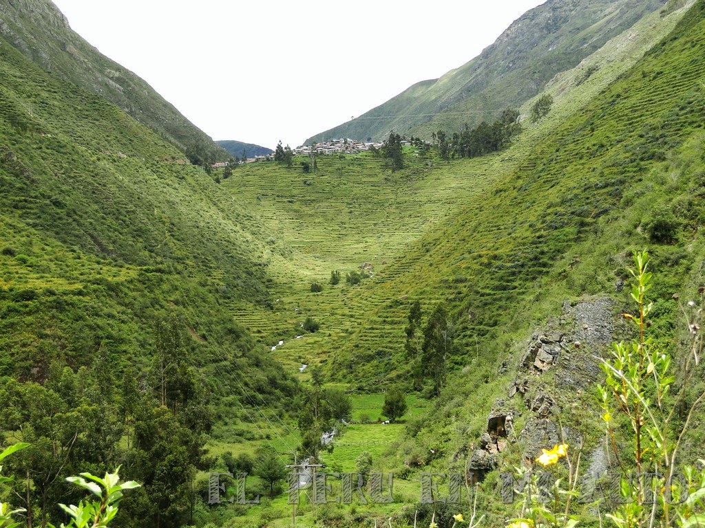
Route to the ancient terraces
Good place to enjoy nature and experiences....

Adventure in Huanchacara
An unparalleled experience. Beautiful natural landscapes. Very energetic and friendly people....

Articles about Trekking
View all →
Infografia: Lo que debes saber sobre el trail running
Para los amantes del Trail Running y quienes ven con buenos ojos la practica de este deporte, les tr...