Zárate Forest Trekking
Sport: Trekking
Route Description
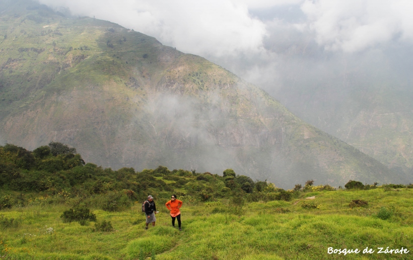
The Zárate Forest is located in the district of San Bartolomé in the province of Huarochirí, covering an area of over 500 hectares. In this place of great biodiversity, a variety of flora and fauna inhabit, considered one of the best places in Lima for trekking in contact with nature.

This forest, named in 2010 by SERNANP as a National Protected Area, is a natural relic, one of the few that survives in the central area of the country. It is a refuge for many species, especially birds like the condor and the white-cheeked cotinga, and it also features attractive archaeological remains.
Where It Takes Place
The starting point is from the chapel in the district of San Bartolomé, then heading on a long and demanding hike to Zárate Forest. People who come here for this adventure usually arrive in the evening and spend the night at the Community Interpretation Center, to then depart very early the next morning towards the forest.
Route
It starts from the chapel in the district of San Bartolomé at 1850 meters above sea level, ascending to 3600 meters above sea level. Along this path, you will enjoy the beautiful landscapes of endless green mountains. You will witness the wide variety of flora and fauna offered by the Reserved Zone of Zárate Forest, and you can also visit archaeological remains along the way.
Distance
This hike covers a distance of 15 to 16 kilometers.
Difficulty Level
To undertake this adventure, some experience in trekking is required, as it is a demanding, long route with some abysses.
Duration
The journey takes a total of 9 hours (round trip), sometimes extending to 10 hours.
Season
The best time to visit this place is between April and June when the mountains display enchanting greenery and the ravines are filled with water.
Video: My Friend Joaquin
What to Bring
- Daypack
- Waterproof clothing
- Trekking shoes
- Warm socks
- Warm clothing
- Sunscreen
- Trekking poles
- Bottled water
- Fruits, energy bars, and nuts for the journey
Recommendations
It is highly recommended to hire guides or an agency to provide you with all the details, technical information, and services you need for this excursion.
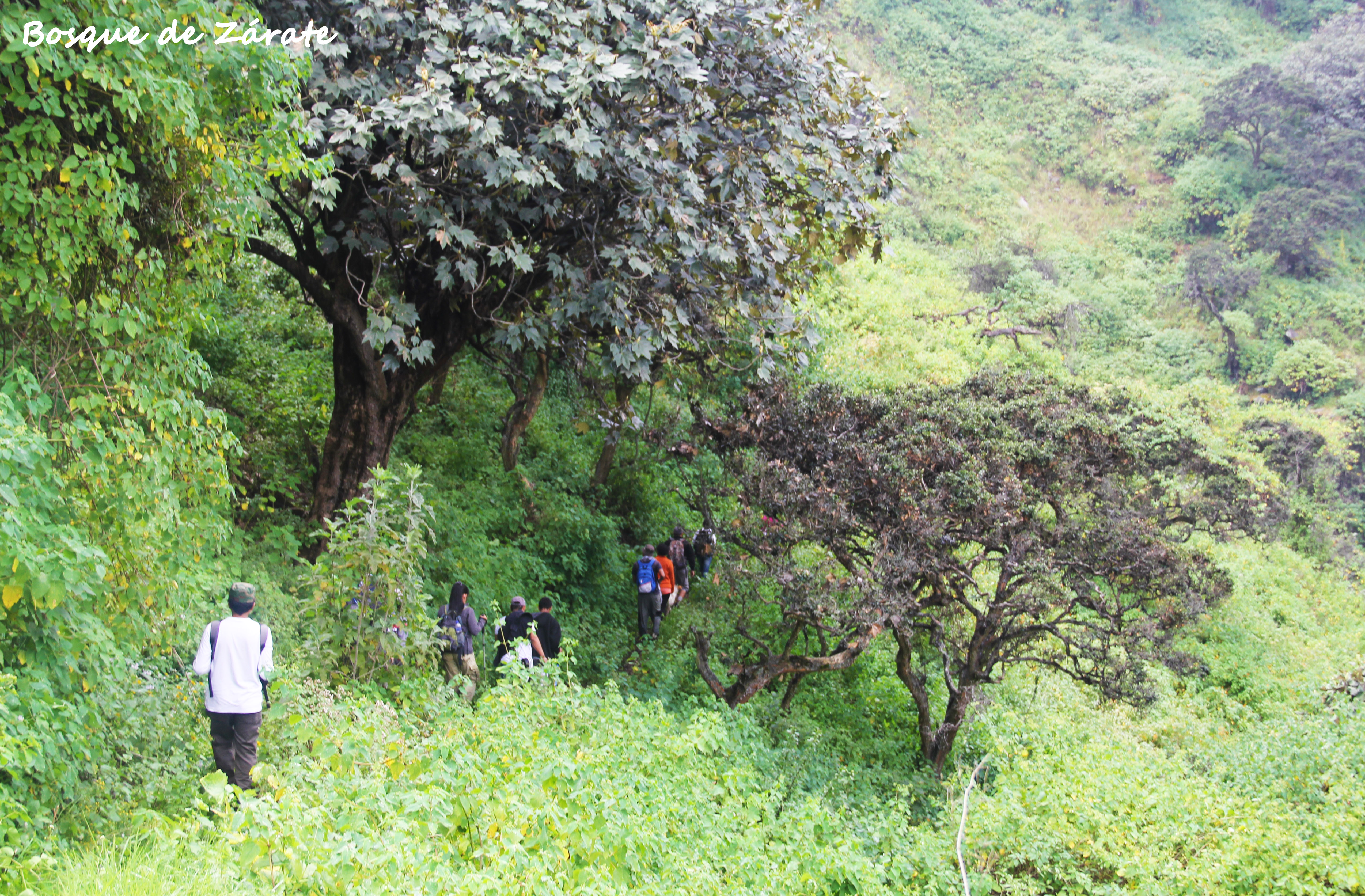
Photo: deportech.wordpress
Key Data about Bosque de Zárate
Altitude
1200.50
Best Season
Abril a Noviembre (temporada seca)
Climate
Templado de montaña
Natural Region
Sierra
Distance
15.50 km
🏃 Available Activities
There are no specific activities registered for this route at this time.
Explore All ActivitiesPlanifica tu aventura
Solicita información o cotizaciones para esta experiencia.
Zárate Forest Trekking