Trekking in Callejón de Conchucos
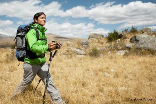
Sport: Trekking
Route Description
In Ancash, to the east of the Cordillera Blanca, the majestic Callejón de Conchucos unfolds. Mystical and historical landscapes converge in this tourist destination, a must-visit for adventurers who enjoy Trekking.
The Callejón de Conchucos is located in the region at the eastern end of the Cordillera Blanca and comprises a set of towns such as Chavín, San Marcos, Huari, Pomabamaba, Sihuas, and more.
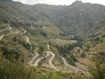
The adventure route in the Callejón de Conchucos:
Two hours by bus from Huaraz is the Catac detour that leads us to the Callejón de Conchucos. The road crosses the Querococha lagoon and the Cahuish tunnel. This is the longest tunnel in Peru, with 580 meters in length. The altitude is 4,516 meters above sea level, from there the descent of the mountain range towards the East begins, to the town of Chavín de Huantar. It is approximately a 110 km journey.
The adventure begins in the city of Chavín, where you can visit the famous archaeological circuit and its new museum. The route continues through the town of San Marcos, 9 km north of Chavín de Huantar, at about 2,960 meters above sea level, in the Mosna valley. There you can take a walk through the Carhuascancha ravine, a wildlife refuge in the heart of Huascarán National Park. Also, a visit to the villages of Carash and Carhuayoc, five and ten minutes from the city center, offer cultural and historical circuits.
From there, we continue through Huari, where you can visit the ecological community of Acopalca and the Dinosaur Footprints Circuit, the oldest fossil on the planet and one of the new tourist products of Conchucos. If you decide to extend your excursion and explore Chacas, the capital of the province of Asunción, there you will find the sanctuary of Mama Ashu and the Chacas museum. Next, you will pass through Huari, the capital of the province of the same name, and you will find Purhuay lagoon, the archaeological site of Marca Jirca, María Jiray waterfall, and the Huanchac area for adventure sports and rock climbing. The great adventure culminates in San Luis, the capital city of the Carlos Fermán Fitzcarrald province, located in the central part of the Callejón de Conchucos at 3131 meters above sea level.
Technical data
| Altitude: 4516 meters above sea level | Best time: May-October |
| Climate: Temperate (12º C to 24ºC) | Level: Intermediate |
When to go?
The best time of year is between May and April as there are no rains during that season. It is not recommended to go between November and March as the first three months of the year are the rainiest.
Travel recommendations:
- Bring waterproof clothing (the weather can surprise us)
- Swimwear
- Light clothing
- Sturdy shoes
- First aid kit
- Sunscreen
- Insect repellent
Key Data about Callejón de Conchucos
Altitude
3500.00
Best Season
Mayo a Septiembre (temporada seca)
Climate
Frío de alta montaña
Natural Region
Sierra
Distance
50.00 km
🏃 Available Activities on Callejón de Conchucos
💡 Tip: These activities are specifically designed for this route. Each one offers a unique experience that complements the main route.
Planifica tu aventura
Solicita información o cotizaciones para esta experiencia.
Trekking in Callejón de Conchucos