Trekking to Laguna Churup
Sport: Trekking
Route Description
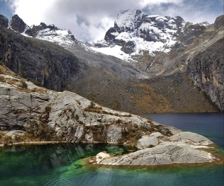
"At the top of the Cordillera Blanca we can appreciate how extraordinary nature can be. There, where the snow-capped mountains thaw, the peaceful Churup lagoon is born, located at an altitude of 4,450 meters".
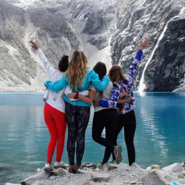
The Churup lagoon is located between the towns of Llupa and Pitec, in the Huascarán National Park. It is situated at an altitude of 4,450 meters above sea level. This lagoon gifts us with an impressive turquoise color that blends with warm hues at sunset. This major tourist attraction for travelers is one of the most visited in Áncash and is only minutes away from Huaraz.
The route:
Many tourists take a bus from the center of Huaraz to the town of Pitec, located to the east of the province. The journey lasts no more than twenty minutes and passes through the towns of Unchus and Llupa. The fare does not exceed five soles. At the beginning of the hike, you enter the Churup gorge and from there you will encounter rough terrain. There are even parts where rock climbing is required.
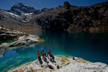
After the initial ascent, the landscape becomes flat, vegetation is visible, and you will feel the change in altitude. The birdsong provides the necessary encouragement to reach the desired destination. Additionally, you can observe waterfalls cascading over rocks. Finally, after about three hours of hiking, you will behold the unique landscape offered by the Churup lagoon. There you will notice the reflection of the Churup snow-capped mountain and the presence of a second lagoon, with calm waters and much smaller in size.
Technical Data of Churup Lagoon
| Area: 867,640 m2 | Difficulty: Moderate |
| Depth:145 meters | Climate: Dry and temperate |
| Altitude: 4,450 meters above sea level |
Best time to visit: April-November |
Climate:
The Churup lagoon has an average temperature of 18ºC. It generally has a dry and temperate climate.
Recommendations:
- Light clothing
- Boots
- Hat
- Insect repellent
- Sunscreen
- Snacks
- Camping tent (optional)
Key Data about Laguna Churup
Altitude
4450.00
Best Season
Mayo a Septiembre (temporada seca)
Climate
Frío de alta montaña
Natural Region
Sierra
Distance
10.00 km
🏃 Available Activities on Laguna Churup
💡 Tip: These activities are specifically designed for this route. Each one offers a unique experience that complements the main route.
Planifica tu aventura
Solicita información o cotizaciones para esta experiencia.
Trekking to Laguna Churup