Trekking in Rainbow Mountain
Sport: Trekking
Route Description
Trekking in Mountain of 7 Colors or Rainbow Mountain is one of the most spectacular attractions on the way to Apu Ausangate. This is an ideal route for trekking enthusiasts.
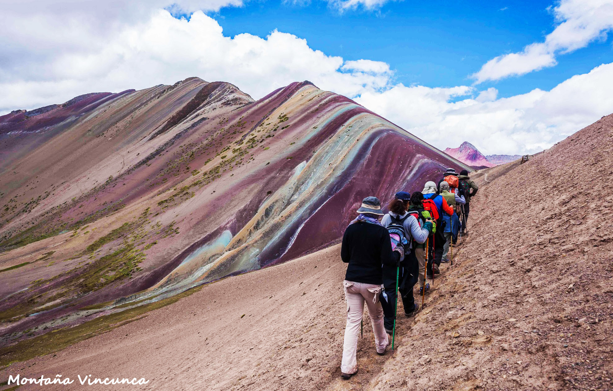
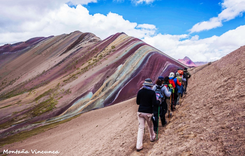
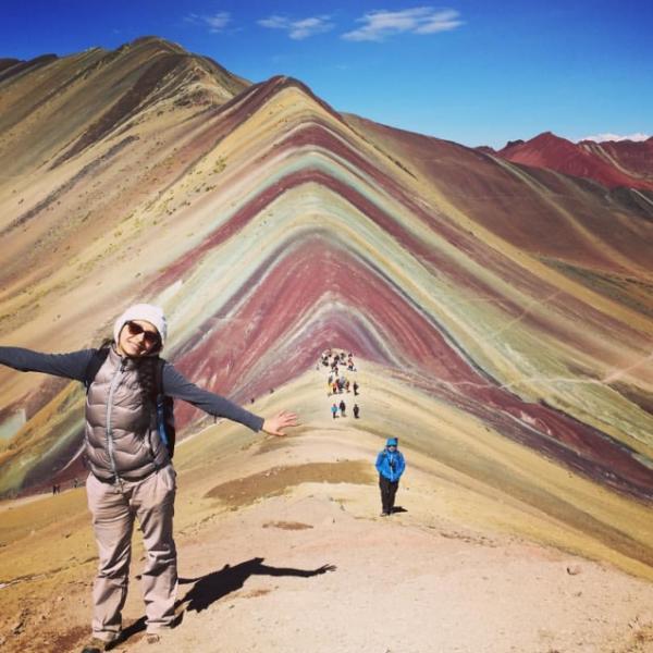
The Mountain of Colors is an impressive place in the Andes mountain range. It has a natural coloring produced by the large amount of sedimentary stones in erosion, giving it a rainbow-like appearance.
Where it takes place
This route starts from the town of Ocefina in the district of Chilca (4500 meters above sea level), then the hike continues until reaching the impressive Rainbow Mountain.
Route
As mentioned, the starting point is from the district of Chilca (4500 meters above sea level), specifically from the town of Ocefina. During the journey, you can see up to 7 varieties of South American camelids, including the llama, alpaca, guanaco, vicuña, taruka, etc. If you are lucky, you may spot the condor and also the Andean feline, the puma. This is a trek in the heart of the mountains, with breathtaking landscapes that make the effort worthwhile, culminating in the wonderful Vincunca Mountain, or simply Cerro Colorado. The return hike is less strenuous and takes less time than the outbound route.
Level
This is an intermediate level trek, recommended for individuals with minimal experience in this adventure sport.
Distance
The route has a total distance of almost 5 kilometers.
Time
The outbound hike lasts between 3 and a half to 4 hours, while the return journey is faster, taking between 2 to 2 and a half hours.
Season
This adventure can be done throughout the year, although the area experiences heavy rains in February, making the route more challenging. The best season for this trek is between the months of March and November.
Video: Maravillas Del Cusco
What to bring
- Trekking shoes.
- Comfortable clothing.
- Backpack with necessary personal items.
- Altitude sickness pills.
- Bottled water.
- Warm jacket.
- Trekking poles.
Recommendations
We recommend undertaking this adventure by hiring the services of an agency specialized in this route; they will provide everything you need, from transportation to Chilca, to lunch for the day.
Key Data about Vinicunca - Montaña de 7 Colores
Altitude
5200.00
Best Season
Mayo a Octubre (temporada seca)
Climate
Frío de alta montaña
Natural Region
Sierra
Distance
15.00 km
🏃 Available Activities on Vinicunca - Montaña de 7 Colores
💡 Tip: These activities are specifically designed for this route. Each one offers a unique experience that complements the main route.
Planifica tu aventura
Solicita información o cotizaciones para esta experiencia.
Trekking in Rainbow Mountain