Trekking in Nevado Copa
Sport: Trekking
Route Description
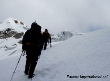
This destination offers a glacial climate, only bearable for the most daring athletes who enjoy Trekking in adverse conditions. Once again, we present a new route in the Cordillera Blanca.
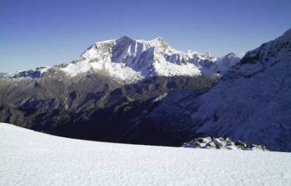
The Nevado Copa stands at an altitude of 6,188 meters above sea level and surprises us with mixed sections of rock and ice that form a breathtaking landscape. It is located in the Hanka or Cordillera region and can be seen from the city of Huaraz. This snow-capped mountain is also known as Chucushcaraju, which means "the mountain with a hat."
From the summit, you can observe the huge plateau that this snow-capped mountain has, where skiing is frequently possible both uphill and downhill depending on the route taken. Along the way to the summit, you can observe the flora and fauna typical of the area, and at the base camp, you will find Laguna Lejiacocha, which sits at an altitude of around 4,600 meters.
The trekking route:
From the city of Huaraz, take public transportation to Marcara, which is located 24 km away; the journey takes no more than 30 minutes. Next is a short bus ride. About 3 km from Marcara is Chancos, the next stop. From Chancos, head towards Vicos in about 10 minutes. From there, the mule track towards the snow-capped mountain begins, allowing you to also appreciate Laguna Lejiacocha. This stretch is about 5 km long and takes approximately three hours.
Best Season
The climate in this part of Áncash is cold and dry. Sometimes the temperature drops significantly, causing frost that tourists face as part of the experience. The best months to travel are June, July, and August.
Technical Data of Nevado Copa
| Location: Cordillera Blanca – Áncash - Peru |
Highest Altitude of Mount Copa: 6,188 meters above sea level |
|
Difficulty: Moderate to Difficult |
Recommended Season: from May to September Day: +13ºC to +23ºC Night: -6ºC to -4ºC |
Recommended Equipment for the Expedition
- Trekking boots
- Trekking socks (synthetic fibers: colmax...)
- Thermal socks
- Microfiber gloves
- Polar fleece or wool gloves
- Padded mittens
- Sun hat and wool hat
- Thermal microfiber shirts
- Waterproof windbreaker jacket
- Trekking pants
- Polar fleece pants
- Waterproof windbreaker pants
- Backpack
- Water bottle
- Headlamp (with spare bulbs and batteries)
- High-altitude sleeping bag (down)
- Sports shoes
- Helmet
- Plastic bags
Key Data about Nevado Copa
Altitude
6188.50
Best Season
Mayo a Septiembre (temporada seca)
Climate
Frío de alta montaña
Natural Region
Sierra
Distance
40.50 km
🏃 Available Activities
There are no specific activities registered for this route at this time.
Explore All ActivitiesPlanifica tu aventura
Solicita información o cotizaciones para esta experiencia.
Trekking in Nevado Copa