Trekking in Nevado Alpamayo
Sport: Trekking
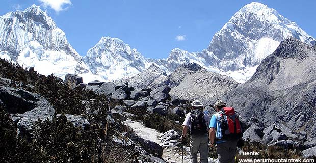
Route Description
"The trekking in Nevado Alpamayo is one of the most challenging routes for adventure sports enthusiasts, but it is also one of the most beautiful places in Peru recognized worldwide."
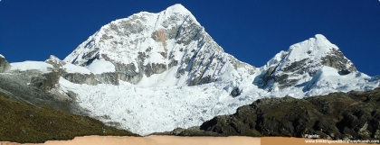
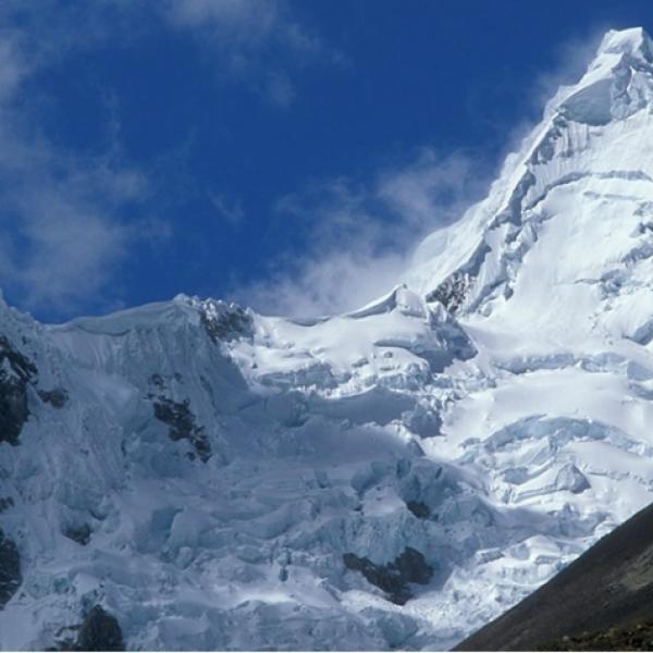
The Nevado Alpamayo is located in the province of Huaylas - Ancash and is part of the Cordillera Blanca. It has an altitude of 5,947 meters above sea level. It is considered one of the most beautiful mountains in the world (Scenic Photography Contest, Munich, 1996). Access is from the city of Caraz at 2,250 meters above sea level, 67 km from Huaraz.
Climate in Nevado Alpamayo:
The climate in Alpamayo is dry and glacially cold. Its average annual temperature is approximately 10°C.
May - October: It is the best time to trek in Alpamayo, as the temperature is drier at the base of the mountain, while it is icy cold at the summit all year round.
Route for Trekking in Alpamayo:
Alpamayo has 14 climbing routes, but the most well-known are:
Ferrari: Short but more dangerous route.
Vasco - French: An alternative route to Ferrari, and the most recommended one.
Direct French: The longest route and is only ascended occasionally.
The most commonly used route by local guides is:
Huaraz - Cashapampa - Llamacoral - Base Camp Arhuaycocha (4,200 meters above sea level) - Camp 1 Alpamayo (5,300 meters above sea level) - Alpamayo Summit (5,947 meters above sea level). Return following the same route.
Tourist Attractions in Nevado Alpamayo:
- Conchucos Alley.
- Llanganuco Gorge.
- Ulta Gorge.
- Hualcán (6,122 meters above sea level).
- Auquiscocha Lagoon.
- Chequiaraju Snowcapped Mountain.
Technical Data of Nevado Alpamayo:
| Location: Huaylas - Ancash | Difficulty: Difficult |
| Climate: Icy | Maximum Altitude: 5,947 meters above sea level |
| Recommended Season: May - October | |
Equipment for Trekking in Nevado Alpamayo:
- Trekking boots.
- High mountain boots.
- Trekking socks.
- Thermal socks.
- Fleece or wool gloves.
- Cold weather hat (fleece or other).
- Microfiber and thermal shirts.
- Thin fiber sweater.
- Waterproof windbreaker jacket.
- Trekking pants.
- Fleece pants.
- Altitude goggles (with side protection).
- Backpack.
- Water bottle.
- Headlamp (with spare bulbs and batteries).
- Sunscreen (for lips and skin).
- Altitude sleeping bag (down).
- First aid kit.
Key Data about Nevado Alpamayo
Altitude
5947.80
Best Season
Mayo a Septiembre (temporada seca)
Climate
Frío de alta montaña, con posibles nevadas y vient
Natural Region
Sierra
Distance
50.50 km
🏃 Available Activities on Nevado Alpamayo
💡 Tip: These activities are specifically designed for this route. Each one offers a unique experience that complements the main route.
Planifica tu aventura
Solicita información o cotizaciones para esta experiencia.
Trekking in Nevado Alpamayo