Trekking in Machu Picchu
Sport: Trekking
Route Description
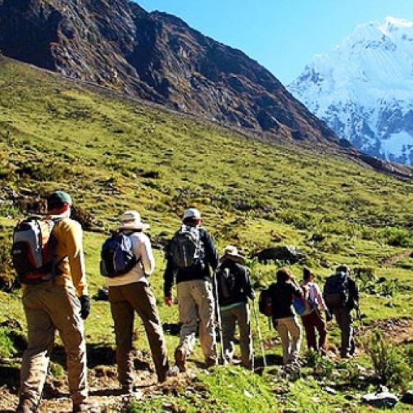
The imposing Inca Citadel takes us through the wonders of the flora and fauna of our Peru. This trekking route is the favorite of thousands of adventure tourists around the world, who make Cusco the meeting point for the best trekking spot.

Photo: latinotravel
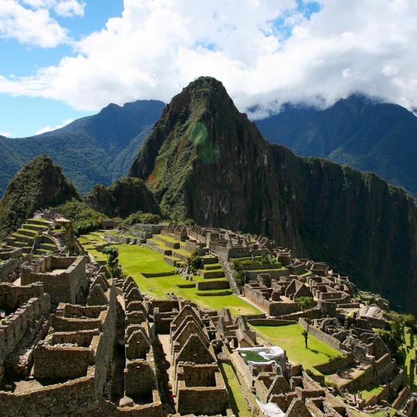
The Inca Citadel is located between the hills of Machu Picchu and Wayna Picchu amidst large forests at 2,430 meters above sea level. It is part of the Machu Picchu district, Urubamba Province. Its name in Quechua means “Old Mountain”.
This is a route where varied ecosystems come together, with impressive Inca architectural monuments, culminating in a beautiful postcard view of Machu Picchu from above. This Inca Trail was designed as a pilgrimage and purification route to reach the sacred place of Pachacútec.
Where It Takes Place
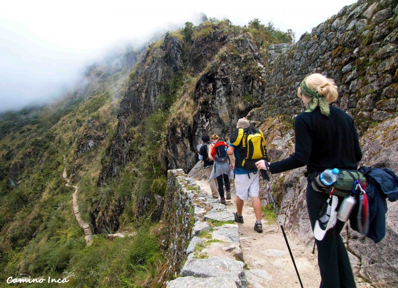
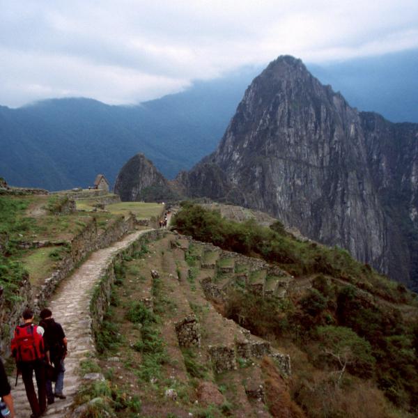
It starts from Qoriwayrachina until reaching Machu Picchu, known as the famous Inca Trail. This is the most famous trekking route in Peru, and for some, it is the best in the world. Annually, more than 25,000 national and foreign hikers traverse the 43 kilometers of stone-paved path built by the Incas.
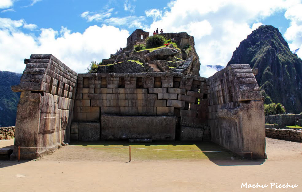
Photo: tressy
Route
To start the journey towards the Sanctuary of Machu Picchu, you must begin from Qoriwayrachina or Kilometer 88, where you must pass the state control and pay the entrance fees, then cross the bridge. Following the trekking path, you should arrive at Patallaqta, then continue along the course of the Kusichaka river and the community of Yunkachinpa to reach Wayllabamba, where you can spend the night as it is the last place where you will find provisions and drinks.
The next day, you must continue to Wuiñay Wuayna, where you will climb large stone stairs. From Wayllabamba at 2,800 meters above sea level, take the path northwest, following the bank of the Llullucha stream, starting the longest ascent that will culminate at the Warmiwañusqa Pass at 4,200 meters above sea level. Then descend to the Pakaymayu Valley. From there, another ascent begins to Runkuraqay at 3,900 meters above sea level, then descend to the archaeological site of Sayaqmarka, reaching the Chakilqocha plain; this is another suitable camping spot. From there, you can reach Phuyupatamarka at 3,680 meters above sea level, where you descend to Wiñaywayna. In this final walk, head towards the Inti Punku, the Sun Gate, and if you arrive very early, you can witness the sunrise over the mountains and clouds.
Overall, the route features a variety of altitudes, climates, and ecosystems; the highest point is Warmiwañuska at 4,200 meters above sea level. One of the most impressive attractions of the trail is the network of ancient settlements, built from granite rock by the Incas, such as Wiñay Wayna and Phuyupatamarca. You can also see over 100 species of orchids, colorful birds, and above all, the beautiful landscapes.
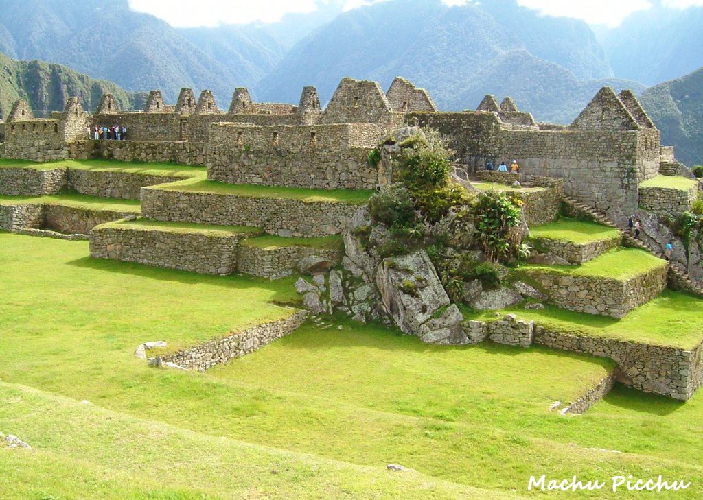
Photo: Jorgelino Vega
Level
The route requires an intermediate level of trekking.
Distance
The total distance covered is almost 40 km.
Time
This Inca Trail is completed in 4 Days and 3 nights. There is also a short route that can be done in 2 Days and 1 night, but it is not the preferred choice for adventurers.
Season
The best season to undertake this adventure is between the months of April and October.
Video: Courtney Prather
What to Bring
- Sleeping Bag.
- Trekking Shoes.
- Backpack with necessary personal items.
- Multi-purpose Knife.
- Altitude Sickness Pills.
- Antivenom Serum.
- Water Purification Tablets.
- Bottled Water.
- Warm Jacket.
- First Aid Kit.
- Trekking Poles.
Recommendations
It is advisable to hire tour agencies that offer this tour to Machu Picchu, as they will provide you with all the details, guides, and necessary equipment to safely undertake this adventure sport.
Key Data about Machu Picchu
Altitude
2430.00
Best Season
Mayo a Octubre (temporada seca)
Climate
Templado seco de montaña
Natural Region
Sierra
Distance
43.50 km
🏃 Available Activities on Machu Picchu
💡 Tip: These activities are specifically designed for this route. Each one offers a unique experience that complements the main route.
Planifica tu aventura
Solicita información o cotizaciones para esta experiencia.
Trekking in Machu Picchu