Trekking in Lunahuaná
Sport: Trekking
Route Description
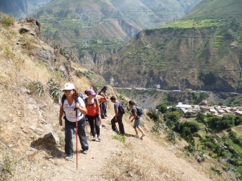
Adventurers, we are back to present a new adventure sport that we can do in Lunahuaná, it's trekking also known as hiking. This adventure is part of the ecotourism that we can do in Lunahuaná, where we will only take long walks around this majestic valley, crossing the Cañete River and other surrounding areas that we will explore. This activity is the second most requested route for hiking while enjoying the ecotourism that this beautiful valley offers.
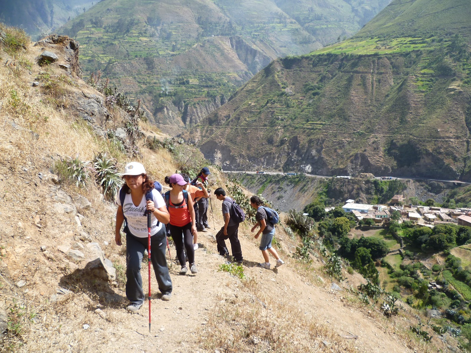
Photo: fotosonline-gratis.blogspot.pe
We are located in the district of Lunahuana in the province of Cañete (38 kilometers to the east) and 182 kilometers southeast of Lima. We will carry out two different hiking routes, the first one will be within the same town and the second one in the area of the town of Catapalla (last annex of Lunahuana) at kilometer 45.5 of the Imperial - Yauyos road.
Start and end of the trekking route in Lunahuaná
In the first route, we can do a trekking to the Haunted House, stroll around the square, enjoy a delicious alfajor, and buy local fruits. We will depart from Cañete towards Lunahuaná, which will take us approximately 40 minutes.
In the second route, we will take the trekking with Oroya crossing. Midway, participants will cross the river using an oroya (sitting on a platform hanging from cables) with strict safety measures (helmet, ropes, carabiners, and life jackets if necessary). Then, we will walk a trail on the other side of the river until we reach the town of Catapalla, where transportation will pick us up to return us to the center of Lunahuana. This activity is the second most requested route for hiking while enjoying the ecotourism that this beautiful valley offers.
-
Difficulty Level
The trekking or hiking is practical, simple, and healthy, adaptable to any age and physical condition, with a great variety of routes in very different environments in Lunahuaná, making it ideal for the first route. Additionally, on the second route, the difficulty level increases to medium as it involves walking on more complex trails.
-
Season: Year-round
What to Bring?
- Personal first aid kit.
- Comfortable backpack.
- Sunscreen.
- Camera.
- Bags for waste disposal.
- Snacks (available for purchase along the route).
Video: Kenny Fosvinder
Recommendations
We recommend wearing sneakers specifically for hiking, light clothing, sunscreen, and plenty of water.
Key Data about Lunahuaná
Altitude
500.00
Best Season
Abril a Noviembre (temporada seca)
Climate
Cálido seco
Natural Region
Costa
Distance
15.50 km
🏃 Available Activities on Lunahuaná
💡 Tip: These activities are specifically designed for this route. Each one offers a unique experience that complements the main route.
Planifica tu aventura
Solicita información o cotizaciones para esta experiencia.
Trekking in Lunahuaná