Paragliding in Pasamayo
Sport: Parapente
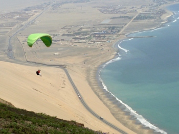
Route Description
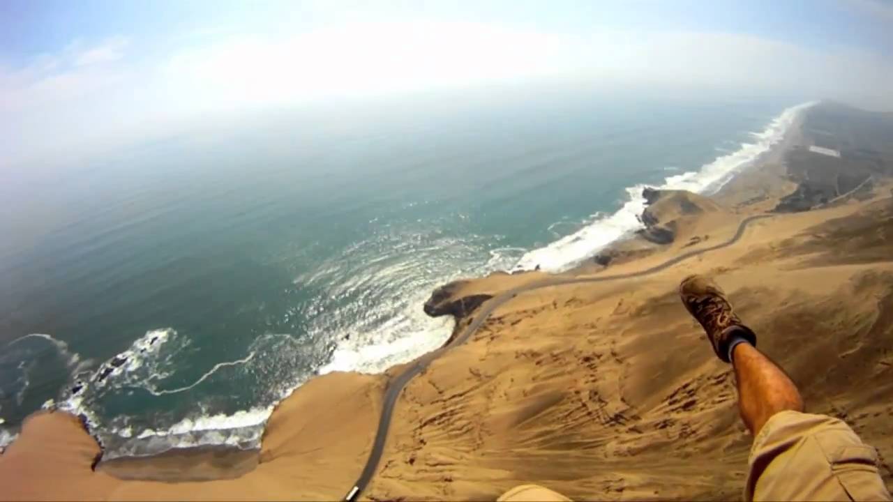
Photo: youtube - viajandoyfirmando
Where it takes place
The "paragliding" starts from the Dunes of Pasamayo, preferably from the highest part, this is not a fixed point since it is an unstable terrain that is constantly changing. The landing can be at the same starting point, as it is a very wide area, or at Toma y Calla beach located in the lower part.
Distance
- Take-off point: 400 meters above sea level.
- Flight altitude: The maximum altitude with good wind is 1000 meters.
Modality
Thermodynamic
Level
It is recommended for experts, as the take-off points have a high level of complexity.
Time
The flight time is 10 to 15 minutes.
Season
All year round, except for some days when visibility is affected by fog.
What to bring
- Sports shoes
- Comfortable clothing
- Sunglasses
- Sunscreen
- Paraglider
- Harness
- Helmet
- *The last 3 items must be provided by the hired agency
Video: Pepe Alcides Pazce Munive
Recommendations
Carry out the activity with experienced paragliding professionals who are familiar with the area's points.
Key Data about Pasamayo
Altitude
600.00
Best Season
Abril a Octubre (temporada seca)
Climate
Desértico costero
Natural Region
Costa
Distance
0.50 km
🏃 Available Activities
There are no specific activities registered for this route at this time.
Explore All ActivitiesPlanifica tu aventura
Solicita información o cotizaciones para esta experiencia.
Paragliding in Pasamayo