Paragliding in Callejón de Huaylas
Sport: Parapente
Route Description
A detail pointed out by enthusiasts of this sport is that from the air, the Cordillera Negra stands out in contrast to the Cordillera Blanca, where the snowy peak of Huascarán is located.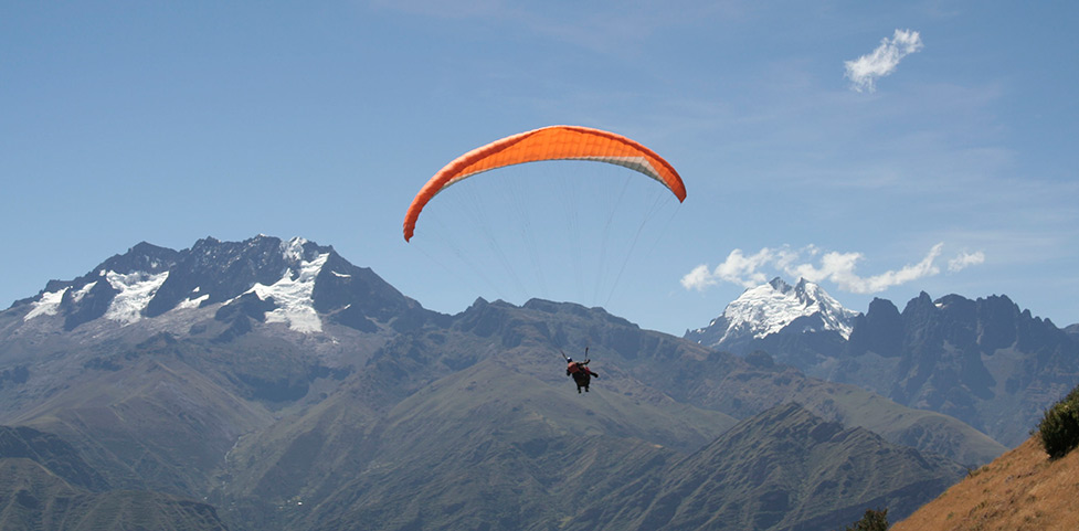
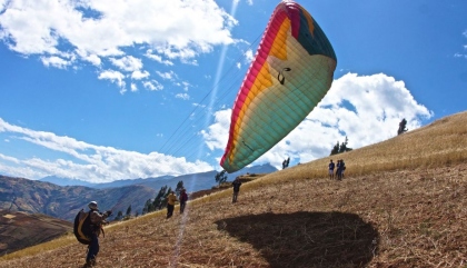
The Callejón de Huaylas is a beautiful valley with high mountains that allow for paragliding descents, specifically around Huaraz and Carhuaz.
The most well-known spot in the area is Cerro Pan de Azucar located in Yungay. Hang gliding is another sport you can practice, taking advantage of the mountain ranges in the area, thanks to the vertical air currents found there.
Climate in Callejon de Huaylas
Varied, highly dependent on altitude. Ranges from dry temperate to glacial cold. Rainfall occurs from September to March, and the so-called Andean warmth arrives from April to August.
How to get to Callejon de Huaylas
We can depart from Lima via the Panamericana Norte until reaching the Pativilca road, then continue eastward to enter the Andean region of Peru, precisely until Conococha, where the Santa River originates.
Then we will follow along the river, through the center of the valley until reaching Huaraz, the capital of Ancash. This route takes approximately 6 hours and covers 400km. It's worth taking the land route to appreciate the numerous snowy peaks and beautiful landscapes that this part of Peru offers.
Technical details of Callejon de Huaylas:
Location: Huaraz Altitude: 6768 maximum
Climate: Semi-dry - Cold Best season: April - November
Difficulty level: high Mode: ascent
Key Data about Callejón de Huaylas
Altitude
3000.50
Best Season
Mayo a Septiembre (temporada seca)
Climate
Templado de montaña
Natural Region
Sierra
Distance
15.50 km
🏃 Available Activities
There are no specific activities registered for this route at this time.
Explore All ActivitiesPlanifica tu aventura
Solicita información o cotizaciones para esta experiencia.
Paragliding in Callejón de Huaylas