Climbing in Nevado Ranrapalca
Sport: Escalada
Route Description
"The Ranrapalca Snowcapped Mountain is one of the most impressive peaks in the Andes Mountain Range. It attracts thousands of adventure tourists every year to engage in climbing activities, due to its enormous height."
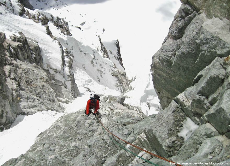
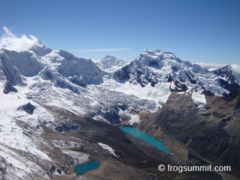
The Ranrapalca Snowcapped Mountain is one of the most impressive peaks in the White Mountain Range, located in Huaraz at an altitude of 6,162 meters above sea level. It is a highly challenging peak and therefore features difficult routes.
Best Climbing Season for Nevado Ranrapalca:
This snowcapped mountain has a cold and dry climate.
June - August: During this time, the weather is more stable, reducing the likelihood of natural inconveniences.
Route to Reach Nevado Ranrapalca:
To climb the Ranrapalca Snowcapped Mountain, it is necessary to hire an experienced guide who knows the ascent routes in the area.
Route 1
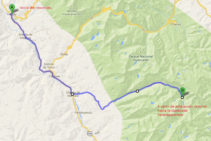
To reach the Ranrapalca Snowcapped Mountain, you must depart from the city of Huaraz towards Yungay, 55km from Huaraz. Then, head towards Llanganuco Ravine, until reaching a place called Cebollapampa at 3,900 meters above sea level. Further on, walk until reaching Lake 69 at 4,400 meters above sea level. At this point, you can rest or continue to the Ishinca Base Camp and cross the Yanarajupampa Ravine at 4,800 meters above sea level. Following the route, you will reach 5,300 meters above sea level at Col Ranrapalca, where you will begin the climb to reach the Ranrapalca summit at 6,162 meters above sea level. The descent is through the same route.
Route 2

Technical Data of Nevado Ranrapalca:
| Location: Andes Mountain Range - Huaraz | Altitude: 6,162m above sea level |
| Climate: Cold - dry | Best Season: June - August |
| Difficulty Level: Difficult | Type of Climbing: Ice climbing |
What to Bring for Climbing in Nevado Ranrapalca?
- Sleeping bag.
- Sun hat, fleece hat.
- Waterproof pants and jackets.
- Ice gloves.
- Ice goggles.
- Headlamp.
- Personal medications.
- Sunscreen.
- Water bottle.
- Down jacket.
- Windbreaker jacket.
- Harness.
- Ice axe.
- Climbing boots.
- Crampons.
- Helmet.
- Ropes, stakes, etc.
Key Data about Nevado Ranrapalca
Altitude
6162.50
Best Season
Mayo a Septiembre (temporada seca)
Climate
Frío de alta montaña
Natural Region
Sierra
Distance
0.50 km
🏃 Available Activities
There are no specific activities registered for this route at this time.
Explore All ActivitiesPlanifica tu aventura
Solicita información o cotizaciones para esta experiencia.
Climbing in Nevado Ranrapalca