Climbing in Nevado Ishinca
Sport: Escalada
Route Description
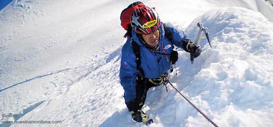
"The Nevado Ishinca is an acclimatization mountain, so its level of difficulty is low, but that doesn't diminish the excitement for amateur climbers or adventure tourists experiencing the adrenaline of climbing for the first time."
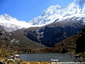
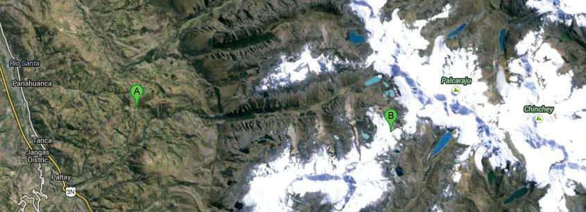
The Nevado Ishinca is an acclimatization mountain, located in Huaraz, part of the Chinchey massif, and situated at the end of the Quebrada Ishinca. It stands at an altitude of 5,530 meters above sea level.
Climate for Climbing Nevado Ishinca:
The Nevado Ishinca has a cold and icy climate. At its base, it can have a temperate climate, depending on the season.
May - September: Recommended period for climbing and other extreme sports.
Route to Reach Nevado Ishinca:
As an acclimatization mountain, the route to reach and start the climb is straightforward.
You must depart from Huaraz towards Pashpa at 3,400 meters above sea level, then head to the base camp Ishinca located at 4,350 meters above sea level. This hike takes around five to six hours. After reaching the base camp, you must begin the climb to the summit at around 5,530 meters above sea level, where you can admire the beautiful landscapes and neighboring snowy peaks from the top. The return journey follows the same path.
Technical Data of Nevado Ishinca:
| Location: Huaraz - Ancash | Altitude: 5,530 meters above sea level |
| Climate: Icy - Cold | Best Season: May - September |
| Difficulty Level: Easy | Type of Climbing: Ice climbing |
What to Bring for Climbing in Nevado Ishinca?
- High mountain boots.
- Thermal socks.
- Gaiters/overboots.
- Fleece or wool gloves.
- Warm hat (fleece or other).
- Microfiber and thermal shirts.
- Fleece pants.
- Waterproof layer.
- Altitude glasses (with side protection).
- Backpack.
- Water bottle.
- Headlamp (with spare bulbs and batteries).
- Sunscreen (for lips and skin).
- Personal first aid kit.
- Sleeping bag.
- Ropes.
- Helmet.
- Descenders.
- Ice screws.
- Slings.
Key Data about Nevado Ishinca
Altitude
5530.00
Best Season
Mayo a Septiembre (temporada seca)
Climate
Frío de alta montaña
Natural Region
Sierra
Distance
2.50 km
🏃 Available Activities
There are no specific activities registered for this route at this time.
Explore All ActivitiesPlanifica tu aventura
Solicita información o cotizaciones para esta experiencia.
Climbing in Nevado Ishinca