Mountain Climbing in Chachani Mountain
Sport: Escalada
Route Description
"The Chachani snow-capped mountain is one of the most accessible snow-capped mountains in the world. Despite its large size, it is very popular among various adventure sports enthusiasts for climbing."
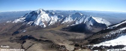
Chachani is located 60 kilometers from Arequipa, it is a stratovolcano, whose origin is due to the extensive chains of peaks that surround it (four in particular). The Chachani Mountain has an altitude of 6,057 meters above sea level. Despite this, it is one of the most accessible mountains in the world, although good physical preparation and proper acclimatization are still necessary.
Climate in Chachani Mountain:
The climate drops below zero degrees.
January - March: The weather in these months is cloudy with afternoon rains, making climbing in the area somewhat challenging, so it is not recommended to visit the mountain during this time.
April - December: It is a good time for adventure tourism in Chachani, as the environment is drier although cold, but free from weather complications.
Climbing Route in Chachani Mountain:
Despite the mountain's altitude of over 6,000 meters, it is considered one of the easiest routes for climbing or other extreme sports, with direct access to the mountain's base.
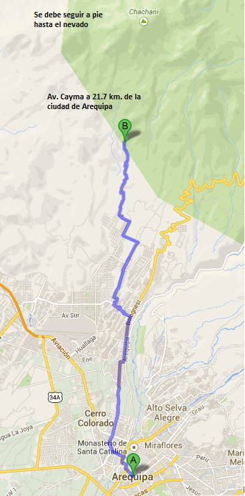
To reach the Chachani snow-capped mountain, one must depart from the city of Arequipa towards Pampa de Matacaballo at approximately 4,200 meters above sea level. 45 km from Arequipa, then ascend to 5,000 meters above sea level. If you have a vehicle, you can reach Chachani more quickly to set up the base camp at the mountain's base and begin the ascent.
Technical Data of Chachani Mountain:
| Location: 60 km from Arequipa | Altitude: 6,057 meters above sea level |
| Climate: Cold - Freezing | Season: April - December |
| Difficulty Level: Moderate |
Type of Climbing: Ice climbing |
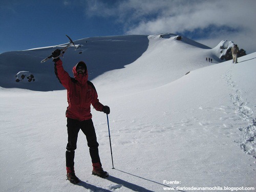
Equipment for Climbing in Chachani Mountain:
- Mountain boots.
- Thermal socks.
- Gloves with wool or fleece lining.
- Waterproof windbreaker jacket.
- Climbing pants.
- Pants with fleece lining.
- Altitude goggles.
- Water bottle.
- Flashlight with spare bulb and battery.
- Sunscreen, first aid kit.
Key Data about Montaña Chachani
Altitude
6075.50
Best Season
Mayo a Septiembre (temporada seca)
Climate
Frío de alta montaña
Natural Region
Sierra
Distance
0.50 km
🏃 Available Activities
There are no specific activities registered for this route at this time.
Explore All ActivitiesPlanifica tu aventura
Solicita información o cotizaciones para esta experiencia.
Mountain Climbing in Chachani Mountain