Shitarero Trail Cycling
Sport: Ciclismo
Route Description
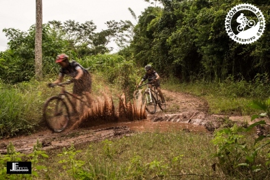
In this route, we depart from the city of Lamas heading towards the Mayo River. We will travel through a 14.5 km route starting from the ancestral city of Lamas, going through the western area of the city through the Huayku neighborhood, belonging to the Quechua Lamas Native Community.
The next point of the route is located northwest towards Shanao, we will travel 3 km on the road and 10 km on a trail until we reach the town. Once there, you can visit the Mayo River and practice other sports such as canoeing. To finish the route, we will exit through the road to the Bolivia Bridge. The total duration of the route is approximately 4 hours and can be done throughout the year, as it is easily accessible. There is even a route without entering the trail for those who prefer a different path.
Key Data about Trocha de Shitarero
Altitude
800.00
Best Season
Mayo a Octubre (menos lluvias)
Climate
Tropical de selva
Natural Region
Selva
Distance
14.50 km
🏃 Available Activities
There are no specific activities registered for this route at this time.
Explore All ActivitiesPlanifica tu aventura
Solicita información o cotizaciones para esta experiencia.
Shitarero Trail Cycling