Mountain Biking in Santo Domingo de los Olleros
Sport: Ciclismo
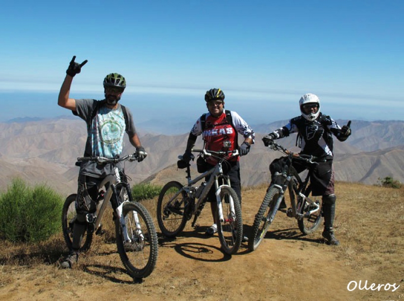
Route Description
Olleros has some of the best routes, such as the Santo Domingo de los Olleros to San Bartolo route, one of the most challenging cycling circuits in Lima for adventure sports enthusiasts, due to its steep inclines and soft terrain, which is why only experts can tackle it.

Santo Domingo de los Olleros is located in the province of Huarochirí, a district known for being one of the main producers of prickly pears in the country, with over 50 kilometers of prickly pear plantations.
The adventure sport practiced in this area of the Huarochirí province is mountain biking. Here, you can find one of the best routes in Lima, which we will describe below.
Where It Takes Place
It starts in Buena Vista at the high part of Santo Domingo de los Olleros at 3300 meters above sea level. The endpoint is at San Bartolo beach, at sea level.
Route
Santo Domingo de los Olleros - San Bartolo
The journey begins from the town of Buena Vista located in the upper part of Olleros, and after a 5-minute climb on a small trail, the first part of the descent to the district center starts, covering a 6-kilometer stretch to warm up and get ready for the journey.
Then, there is a 20-kilometer descent with a drop of about 2500 meters until reaching Huayco, the entire route is characterized by being very arid. The terrain varies, sometimes firm and at other times very sandy and loose with many rocky areas.
Once in Huayco (a good place to rest and recharge), the route continues through the Quebrada Cruz de Hueso, a 30-kilometer path that separates from the sea. Finally, you arrive at San Bartolo, where you can enjoy a well-deserved swim at the beach after the intense journey.
Santo Domingo de los Olleros is also the venue for national MTB championships, such as the ones organized annually by A Puro Pedal. There are also other routes, although less popular, such as Olleros - Pachacámac and Olleros - Cucuyá.

Duration
Approximately 6 hours, depending on the number of stops and the speed.
Distance
56 km
Type
It is a cross-country route, but most of it is downhill.
Season
The best season to enjoy this adventure sport is between the months of May and October when the area has sunny and mild weather.
Difficulty Level
It is a challenging route, therefore not suitable for beginners as it involves very risky downhill sections.

What to Bring
- Helmet
- Goggles
- Gloves
- Large water bottle
- Cycling shorts or tights
- Cycling jersey
- Spare tube
- Repair kit
- Pump
- Multi-tool
Recommendations
We recommend bringing swimwear and a change of clothes so that when you arrive at San Bartolo, you can enjoy a fun and relaxing swim at its beaches.
Video: Arturo Bullard
Key Data about Santo Domingo de los Olleros
Altitude
1200.50
Best Season
Mayo a Septiembre (temporada seca)
Climate
Templado seco de montaña
Natural Region
Sierra
Distance
35.70 km
🏃 Available Activities
There are no specific activities registered for this route at this time.
Explore All ActivitiesPlanifica tu aventura
Solicita información o cotizaciones para esta experiencia.
Mountain Biking in Santo Domingo de los Olleros