Cycling in Lomas de Atiquipa
Sport: Ciclismo
Route Description
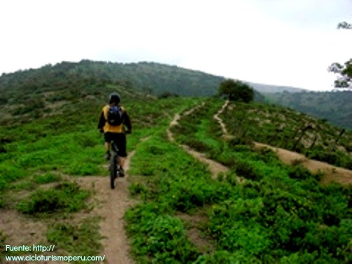
In Arequipa, we find an unmissable destination for adventurous cyclists seeking excitement and adrenaline. The Lomas de Atiquipa captivate those who venture along its trail, offering fun and ecological diversity to its extreme sports enthusiasts.
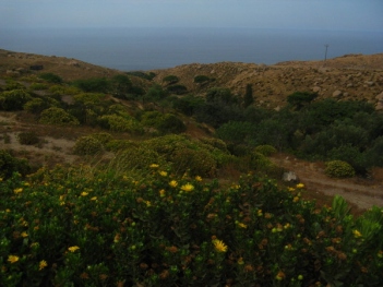
The Lomas de Atiquipa are located about 415 km from the city of Arequipa, in the Caravelí province. It has an average altitude of 345 meters above sea level. Along the route, you can appreciate pre-Hispanic complexes, chullpas, and ceremonial centers. All this landscape is accompanied by attractive vegetation that makes it one of the largest ecological areas in the southern region of our country.
Climate in Lomas de Atiquipa:
Generally, the climate is semiwarm and arid. Between the months of May to November, the hills are covered by clouds and thick fog, which is favorable for the development of vegetation but not so suitable for cycling.
Therefore, it is recommended to travel between the months of December to April.
Route to reach Lomas de Atiquipa:
From the city of Arequipa, we must take a bus heading northwest, towards kilometer 48, and continue along the Pan-American Highway. We will pass through the Pampas de Majes, then take the detour towards Camaná and head north passing through Ocoña, Atico, and Chala until we reach the entrance to Lomas de Atiquipa.
From there, the journey begins in the Waca to Agua Salada ravine, totaling 14 kilometers.
Technical data of Lomas de Atiquipa:
| Location: Caravelí, Arequipa | Modality: Road cycling |
| Maximum Altitude: 345 meters above sea level | Climate: Semiwarm and arid |
| Difficulty Level: Easy | Best Season: December to April |
What to bring for cycling in Lomas de Atiquipa?
- Small backpack on your back (school size).
- One liter of water and one of rehydrating drink.
- Energetic snack.
- Camera.
- Cycling helmet.
- Cycling gloves.
- Polycarbonate glasses.
- Mountain bike in good condition.
- Lightweight air pump.
- High-pitched whistle.
Key Data about Lomas de Atiquipa
Altitude
1000.50
Best Season
Abril a Noviembre (temporada seca)
Climate
Desértico de montaña
Natural Region
Costa
Distance
25.70 km
🏃 Available Activities
There are no specific activities registered for this route at this time.
Explore All ActivitiesPlanifica tu aventura
Solicita información o cotizaciones para esta experiencia.
Cycling in Lomas de Atiquipa