Whitewater Rafting on the Chili River
Sport: Canotaje
Route Description
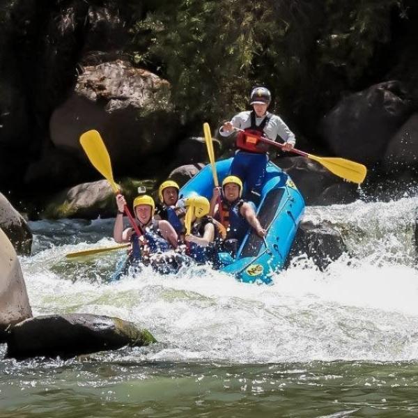
The Chili River is a low-flow river, but it offers a unique experience in the city of Arequipa. This river is ideal for hikers looking for a technical, fast, and fun river with Class II, III, and IV rapids.
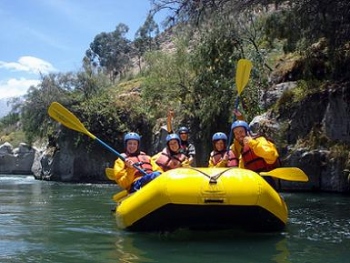
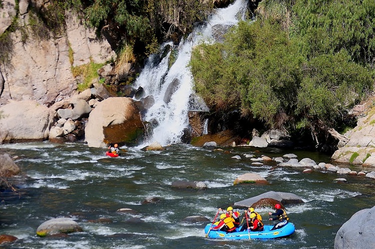 Photo: www.panoramio.com
Where is the Chili River located?
The Chili River is located just 25 to 30 minutes from the Plaza de Armas in Arequipa, where you can find the beautiful Chilina Valley at the foot of the Misti volcano. The river Chili flows through this area free of pollution and amidst impressive walls of volcanic rock. The Chilina Valley extends approximately 15 km, located between 2493 m and 2578 m in Cayma.
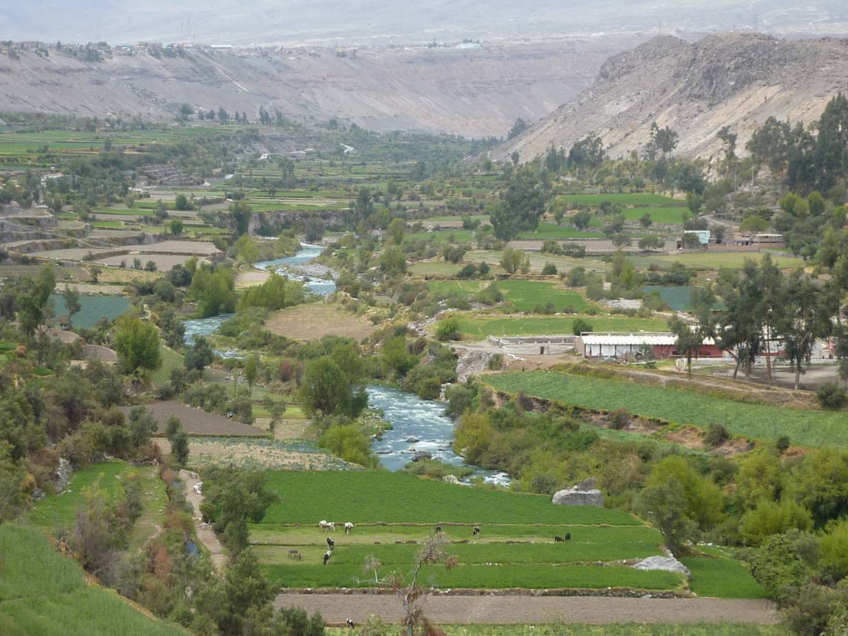 Photo: www.madrimasd.org
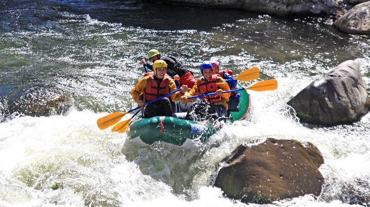 Photo: tolongedecasa.com
Rafting Sections
In the Chili River, you will find sections with rapids ranging from level I (basic) to level III (intermediate) and 2 level IV (advanced) rapids.
- Between Charcani - Carmen Alto: To practice this activity, head to the area known as the Gruta de la Virgen de Chapi in Charcani, located at the head of the Chilina Valley. You will receive an instructive talk on the correct use of the equipment and after taking all necessary safety measures for the activity, the descent begins. The descent on the river covers a stretch of 6 km, lasting between 1:30 to 2:00 hrs. All within the Chilina Valley with an excellent view of Misti and Chachani, as well as the volcanic rock formations on the sides of the river, with Class III and IV rapids.
- Chachani Circuit: Located near the Misti volcano, this circuit is ideal for those seeking calm thrills, just 20 minutes from the center of the city of Arequipa. The descent covers a 6 km stretch, offering a fascinating journey through Class I and II rapids for approximately 1.5 hours, observing a varied diversity of fauna and flora, ending the journey in the Chilina Valley, 2 kilometers from the city.
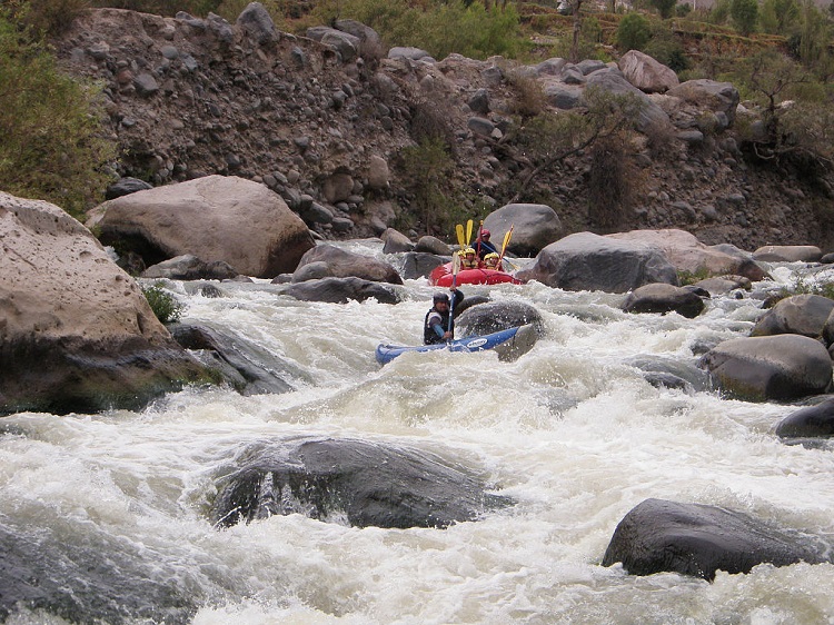 Photo: commons.wikimedia.org
The total time for the expedition is approximately 3 to 4 hours, including transportation to the river, the river journey, and the return to the city.
Rapids Difficulty: Intermediate with Class II, III, IV
Season: From April to December, it is recommended to do tourist rafting from May to December, when river flows are not dangerous.
Source: Expediciones y Aventuras
Key Data about Rio Chili
Altitude
2300.50
Best Season
Abril a Noviembre (temporada seca)
Climate
Desértico de montaña
Natural Region
Sierra
Distance
15.50 km
🏃 Available Activities on Rio Chili
💡 Tip: These activities are specifically designed for this route. Each one offers a unique experience that complements the main route.
Planifica tu aventura
Solicita información o cotizaciones para esta experiencia.
Whitewater Rafting on the Chili River